
Philippines Taal Volcano Could Erupt Anytime!
Posted by feww on May 19, 2008
UPDATE: Latest From TAAL and other Philippines Volcanoes
Taal May Erupt at Anytime
FEWW team believes there is a strong probability that the Taal Volcano, a Pelean-type active volcano on the island of Luzon, might erupt this month. Taal volcano is designated as one of the 16 Decade Volcanoes by International Association of Volcanology and Chemistry of the Earth’s Interior (IAVCEI). Located about 50 km south of the capital, Manila, Taal is surrounded by populated areas.
Taal has erupted violently several times (the last eruption was in 1977). The current death toll caused by its activities stands at about 6,000.
More seismic activities in the region should be expected.

Taal Volcano Seen through Lake Taal (Photo: Jhun Taboga)

A cinder cone in an acidic lake on Taal Volcano (Credit: JG Moore of the US Geological Survey)

Major volcanoes of the Philippines
Pacific Ring of Fire

The Pacific Ring of Fire is an area of frequent earthquakes and volcanic eruptions encircling the basin of the Pacific Ocean. The Ring of Fire has 452 volcanoes and is home to over 75% of the world’s active and dormant volcanoes. Ninety percent of the world’s earthquakes and 80% of the world’s largest earthquakes occur along the Ring of Fire. The Ring of Fire is a direct result and consequence of plate tectonics and the movement and collisions of crustal plates. (Source)
Plate Tectonics

World’s 14 major tectonic plates plus the Scotia plate. Mapped in the second half of the 20th century to explain the observed evidence for large scale motions of the Earth’s lithosphere. The lithosphere is broken up into tectonic plates. The surface of the Earth consists of a further 38 [40] minor plates.
The largest of the major plates are
- African Plate, containing Africa – Continental plate
- Antarctic Plate, containing Antarctica – Continental plate
- Australian Plate, containing Australia (fused with Indian Plate about 50 million years ago) – Continental plate
- Eurasian Plate containing Asia and Europe – Continental plate
- North American Plate containing North America and north-east Siberia – Continental plate
- South American Plate containing South America – Continental plate
- Pacific Plate, covering the Pacific Ocean – Oceanic plate
See also
- Plates list.
- Detailed map showing the tectonic plates with their movement vectors.
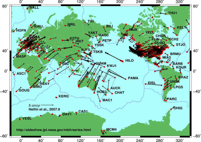
- Plate motion based on Global Positioning System (GPS) satellite data from NASA JPL
Earthquakes, volcanic activity, mountain-building, and oceanic trench formation occur along plate boundaries. The lateral movement of the plates is typically at speeds of 5 – 10 cm/yr. (Read more …)
Recent Earthquakes [Kurile through Kermadec trenches]
[Time at epicenter]
- Magnitude 4.8; Depth of 48.7 km; SOUTHEAST OF THE LOYALTY ISLANDS; Sunday, May 18, 2008 at 10:03:52 PM
- Magnitude 5.6; Depth of 35 km; SOUTHERN SUMATRA, INDONESIA; May 18, 2008 at 07:17:24 PM
- Magnitude 4.6; Depth of 74.1km; MINDORO, PHILIPPINES; Sunday, May 18, 2008 at 07:24:17 PM
- Magnitude 4.9; Depth of 10 km; SABAH, MALAYSIA; Sunday, May 18, 2008 at 02:26:41 PM
- Magnitude 4.9; Depth of 31.3 km; NIAS REGION, INDONESIA; Sunday, May 18, 2008 at 09:59:59 AM
- Magnitude 4.4; Depth of 242.4 km;KYUSHU, JAPAN; Sunday, May 18, 2008 at 07:15:06 AM
- Magnitude 5.2; Depth of 127.1 km, MINDANAO, PHILIPPINES, Saturday, May 17, 2008 at 10:17:30 PM
- Magnitude 5.1; Depth of 151.2 km; SOUTH OF THE KERMADEC ISLANDS; Saturday, May 17, 2008 at 02:23:17 PM
- Magnitude 5.3; Depth of 150.4 km; NEW BRITAIN REGION, PAPUA NEW GUINEA; Saturday, May 17, 2008 at 03:35:14 AM
- Magnitude 5.4; Depth of 35 km; SOUTH OF THE KERMADEC ISLANDS; Friday, May 16, 2008 at 11:06:51 PM
- Magnitude 5.3; Depth of 41 km; SANTA CRUZ ISLANDS REGION; Friday, May 16, 2008 at 09:19:07 AM
- Magnitude 4.9; Depth of 606.3 km; FIJI REGION; Thursday, May 15, 2008 at 10:46:02 AM
- Magnitude 5.1; Depth of 35 km; TONGA; Friday, May 16, 2008 at 03:06:15 AM
- Magnitude 5.0; Depth of 25.8 km; KURIL ISLANDS; Wednesday, May 14, 2008 at 08:20:43 AM
- Magnitude 5.2; Depth of 52.5 km; LUZON, PHILIPPINES; Wednesday, May 14, 2008 at 05:48:32 AM
- Magnitude 5.2; Depth of 40.8 km; LUZON, PHILIPPINES; Depth of 40.8 km; Tuesday, May 13, 2008 at 10:14:30 PM
- Magnitude 5.4; Depth of 35 km; NORTHERN SUMATRA, INDONESIA; Tuesday, May 13, 2008 at 05:29:19 PM
- Magnitude 5.0; Depth of 36.7 km; TAIWAN REGION; Tuesday, May 13, 2008 at 06:57:46 AM
- Magnitude 4.6; Depth of 509 km; SOUTH OF THE FIJI ISLANDS; Monday, May 12, 2008 at 04:34:05 AM
[Source: USGS]

Global earthquake epicentres, 1963–1998 (Image: NASA)
Philippines Other Major Volcanoes: Mayon Volcano

Mayon Volcano as viewed from Lingñon Hill in Daraga, Albay. Mayon, located between the Eurasian and the Philippine Plate, is a convergent plate boundary. It is the most active volcano in the Philippines, having erupted over 47 times in the past 400 years. Last eruption: 2006. (Copyrigh by Tam3rd via Wikimedia)
Canlaon Volcano

Canlaon, a stratovolcano, is located in the north central part of the island of Negros. Last eruption: 2006.
Weather clouds drape the sparsely vegetated summit of Kanlaon volcano (also spelled Canlaon). Kanlaon is the most active of the central Philippines and forms the highest point on the island of Negros. The massive 2435-m-high stratovolcano is dotted with fissure-controlled pyroclastic cones and craters, many of which are filled by lakes. Historical eruptions, recorded since 1866, have typically consisted of phreatic explosions of small-to-moderate size that produce minor ashfalls near the volcano. Photo courtesy of PHIVOLCS. Caption GVP
Ragang volcano

Ragang volcano (above and to the right of the center of image) is located in central Mindanao. Last eruption: 1916. Thanks mainly to the Filipino government and its education authorities, no other image of Ragnag Volcano could be found at the time of writing. NASA Space Shuttle image STS61A-40-71, 1985 (http://eol.jsc.nasa.gov/).
There are 22 active volcanoes in the Philippines: Babuyan Claro, Banahaw, Bulusan, Mount Biliran, Bud Dajo, Cagua, Camiguin de Babuyanes, Didicas, Hibok-Hibok, Iraya, Mount Iriga, Mount Kanlaon, Leonard Kniaseff, Makaturing, Matutum, Mayon, Musuan, Mount Parker (Cotabato), Pinatubo, Ragang, Smith Volcano, Taal.
See also: List of volcanoes in the Philippines
Related Links:
- The Power of Chaitén Volcano
- Volcanoes, Santorini Eruption and Crops Failure in China
- Chaitén Volcano Still Active
- Parts of pyroplastic chamber fall around Chaitén volcano
- RESIDENTS IN CHILE VOLCANO ZONE WITHOUT DRINKING WATER
- CHILE VOLCANO ZONE MAY BE PERMANENTLY UNLIVABLE
- Volcano gets active, region is evacuated
- Thousands evacuated as Chile volcano spews ash
- Will one or both of New Zealand islands break up and sink in the south-western Pacific Ocean?

Andy soler said
… if there is so much danger of a volcanic eruption any time in Taal , why is it that a development company purchased and still constructing in the entire area of Taal Volcano from the ridge top to nearing the lake . And why are people investing there money hard earned or not . The developers because of their greed do not care if an eruption of Taal takes place . And why did the goverment issue them a permit to develop ? Again also because of greed ! When will this country really realize that of the greed they are saving will not get them to where one should go after there life ! This country is going to hell and at this point and time it already is . Can we not learn the precious value of life and not the temporary pleasures that it gives , can we not no when to much is to much . Can we not measure and be satisfied with what we already have made . At any rate go ahead develop the place and if Taal erupts blame and do the usual stupid goverment investigation that is always done then blame each other till nothing comes out of it . Then when thousands have died , find another place to develop again ! ! ! !
feww said
Most of Japan’s nuclear power plants are located withing “striking” distance of one or more active volcanoes.
Lanna said
feww said
When in Rome, don’t do…
Remember Mt Vesuvius!
inca said
[1. Yes we do! 2. No, not right now. Moderator]
feww said
TAAL VOLCANO BULLETIN, 14 April 2011,8:00 A.M.
Thursday, 14 April 2011 07:21
The seismic network around Taal Volcano (14.0000°N, 120.9833°E) recorded twelve (12) volcanic earthquakes during the past 24 hours. Two of these earthquakes were felt. The first event occurred at 4:32 A.M and was felt at Intensity II by residents in Barangay Calauit at the southeastern part of Taal Volcano Island with an audible rumbling sound. The second event occurred a few minutes later at 4:49 A.M., but felt only at Intensity I with faint rumbling sound in the same area. Water temperature at the Main Crater Lake slightly increased from 30.0°C to 30.5°C. Gas measurements conducted at Taal Main Crater Lake last January, February and March 2011 yielded carbon dioxide (CO2) emission values of 2,250 tonnes per day (t/d), 1,875 t/d and 4,670 t/d respectively. This large increase in C02 concentration indicates gas release from the magma at depth. Result of the ground deformation survey (precise leveling) conducted around the Volcano Island last 05-11 April 2011 showed that volcano edifice is slightly inflated as compared with the 02-09 February 2011 survey.
Alert Level 2 is hoisted over Taal Volcano with the interpretation that magma has been intruding towards the surface, as manifested by CO2 being released in the Main Crater Lake and increase in seismic activity. Hence, PHIVOLCS advises the public that the Main Crater, Daang Kastila Trail and Mt. Tabaro (1965 -1977 Eruption Site) are strictly off-limits because sudden hazardous steam-driven explosions may occur and high concentrations of toxic gases may accumulate. Breathing air with high concentration of gases can be lethal to human, animals and even cause damage to vegetation. In addition, it is reminded that entire Volcano Island is a Permanent Danger Zone (PDZ), and permanent settlement in the island is strictly not recommended. DOST-PHIVOLCS is closely monitoring Taal Volcano’s activity and any new significant development will be immediately relayed to all concerned.
DOST-PHIVOLCS
– BULUSAN VOLCANO BULLETIN,14 April 2011,8:00 A.M.
– MAYON VOLCANO BULLETIN, 14 April 2011, 8:00 A.M.
http://www.phivolcs.dost.gov.ph/index.php?
feww said
TAAL VOLCANO BULLETIN 11 April 2011 8:00 A.M.
Monday, 11 April 2011 08:21
Taal Volcano’s (14.0000°N, 120.9833°E) seismic network recorded seven (7) volcanic earthquakes during the past 24 hours. Water temperature slightly increased from 30.0°C to 30.5°C. Gas measurements conducted at Taal Main Crater Lake last January, February and March 2011 yielded carbon dioxide (CO2) emission values of 2,250 tonnes per day (t/d), 1,875 t/d and 4,670 t/d respectively. The remarkable increase in C02 concentration indicates anomalous gas release from the magma at depth. Result of the ground deformation survey (precise leveling) conducted around the Volcano Island last 05-11 April 2011 showed that volcano edifice is slightly inflated as compared with the 02-09 February 2011 survey.
Alert Level 2 is hoisted over Taal Volcano with the interpretation that magma has been intruding towards the surface, as manifested by CO2 being released in the Main Crater Lake and increase in seismic activity. Hence, PHIVOLCS advises the public that the Main Crater, Daang Kastila Trail and Mt. Tabaro (1965 -1977 Eruption Site) are strictly off-limits because sudden hazardous steam-driven explosions may occur and high concentrations of toxic gases may accumulate. Breathing air with high concentration of gases can be lethal to human, animals and even cause damage to vegetation. In addition, it is reminded that entire Volcano Island is a Permanent Danger Zone (PDZ), and permanent settlement in the island is strictly not recommended. DOST-PHIVOLCS is closely monitoring Taal Volcano’s activity and any new significant development will be immediately relayed to all concerned.
DOST-PHIVOLCS
feww said
ISSUED BY DOST-PHIVOLCS–http://www.phivolcs.dost.gov.ph/
TAAL VOLCANO BULLETIN, 01 March 2011, 8:00 A.M.
Tuesday, 01 March 2011 07:32
Taal Volcano’s (14°00.1’N, 120°59.6’E) seismic network did not record any volcanic earthquake during the past 24 hours. Field observation conducted last 22 February 2011 at the eastern sector inside the Main Crater Lake (via Calauit) showed that steaming activity at the thermal area was weak. The crater lake level further receded from 0.68 meter to 0.60 meter. The lake water temperature slightly lowered from 30.70C to 30.5 0C while the pH value became less acidic from 2.86 to 2.97. Results of the ground deformation survey (precise leveling) conducted around the Volcano Island this February showed a slight inflation as compared with the December 2010 survey.
Alert Level 1 is still enforced over Taal Volcano. This means that a hazardous eruption is not imminent. However, the public is reminded that the Main Crater should be strictly off-limits due to sudden occurrence of steam explosions and accumulation of toxic gases. The northern portion of the Main Crater rim, in the vicinity of Daang Kastila trail, may also be dangerous when increased steam emission is reactivated along existing fissures. Moreover, the public is also reminded that the entire Volcano Island is a Permanent Danger Zone (PDZ), and permanent settlement in the island is strictly not recommended.
DOST-PHIVOLCS
Sandra said
[Thank you for kind words. Moderator]
Strong Quake Strikes Mindoro Philippines « Fire Earth said
[…] The epicenter of the shock was located near13.71ºN, 120.12ºE about 135 km (85 miles) SW of MANILA, Philippines and 105km WSW of TAAL volcano. […]
Ruby said
thanks for all your info here… I’ll keep on praying for Philippines!
“Twin-engine” hurricanes, “Supercharged” Typhoons « Fire Earth said
[…] Could Manila collapse as a result of devastation caused by the combined impact of the storms Ketsana, Parma (and Melor, next week), as well as possible earthquakes triggered by landslides and massive mud avalanches, AND a highly probable catastrophic eruption of TAAL VOLCANO? […]
Victoria said
Thaaaaaank-You! This helped my so much!
feww said
Glad to be of help!
brian said
thanks man the site helped me a ton im doing a research project on canlaon
feww said
Good luck!
feww said
Kristine – thanks for visiting the blog. Would you care to share your story with our readers?
jatin dela rosa said
kristine said
thanks for this this really hleped me thanks a lot
Latest From TAAL and other Philippines Volcanoes « Fire Earth said
[…] by feww on August 31, 2008 As per FEWW Forecast, Taal Volcano’s of seismic unrest may lead to explosive […]