El Niño conditions is in progress —NOAA
Posted by feww on July 10, 2009
ENSO Cycle Report by Climate Prediction Center / NCEP July 6, 2009
A transition from ENSO-neutral to El Niño conditions is currently in progress.
-
A transition from ENSO-neutral to El Niño conditions is occurring in the equatorial Pacific Ocean.
-
Positive SST departures are increasing across much of the equatorial Pacific Ocean.
-
Observations and dynamical model forecasts currently indicate a transition from ENSO-neutral to El Niño conditions is in progress.
NOAA Operational Definitions for El Niño and La Niña
-
El Niño:characterized by a positive ONI greater than or equal to +0.5°C.
-
La Niña:characterized by a negative ONI less than or equal to -0.5°C.
By historical standards, to be classified as a full-fledged El Niño or La Niña episode, these thresholds must be exceeded for a period of at least 5 consecutive overlapping 3-month seasons.
CPC considers El Niño or La Niña conditionsto occur when the monthly Niño3.4 SST departures meet or exceed +/-0.5°C along with consistent atmospheric features. These anomalies must also be forecast to persist for 3 consecutive months.
Oceanic Niño Index (ONI)
-
The ONI is based on SST departures from average in the Niño 3.4 region, and is a principal measure for monitoring, assessing, and predicting ENSO.
-
Defined as the three-month running-mean SST departures in the Niño 3.4 region. Departures are based on a set of improved homogeneous historical SST analysis (Extended Reconstructed SST –ERSST.v3b). The SST reconstruction methodology is described in Smith et al., 2008, J. Climate, vol. 21, 2283-2296.)
-
Used to place current events into a historical perspective
-
NOAA’s operational definitions of El Niño and La Niña are keyed to the ONI index.
SST Departures (°C) in the Tropical Pacific During the Last 4 Weeks

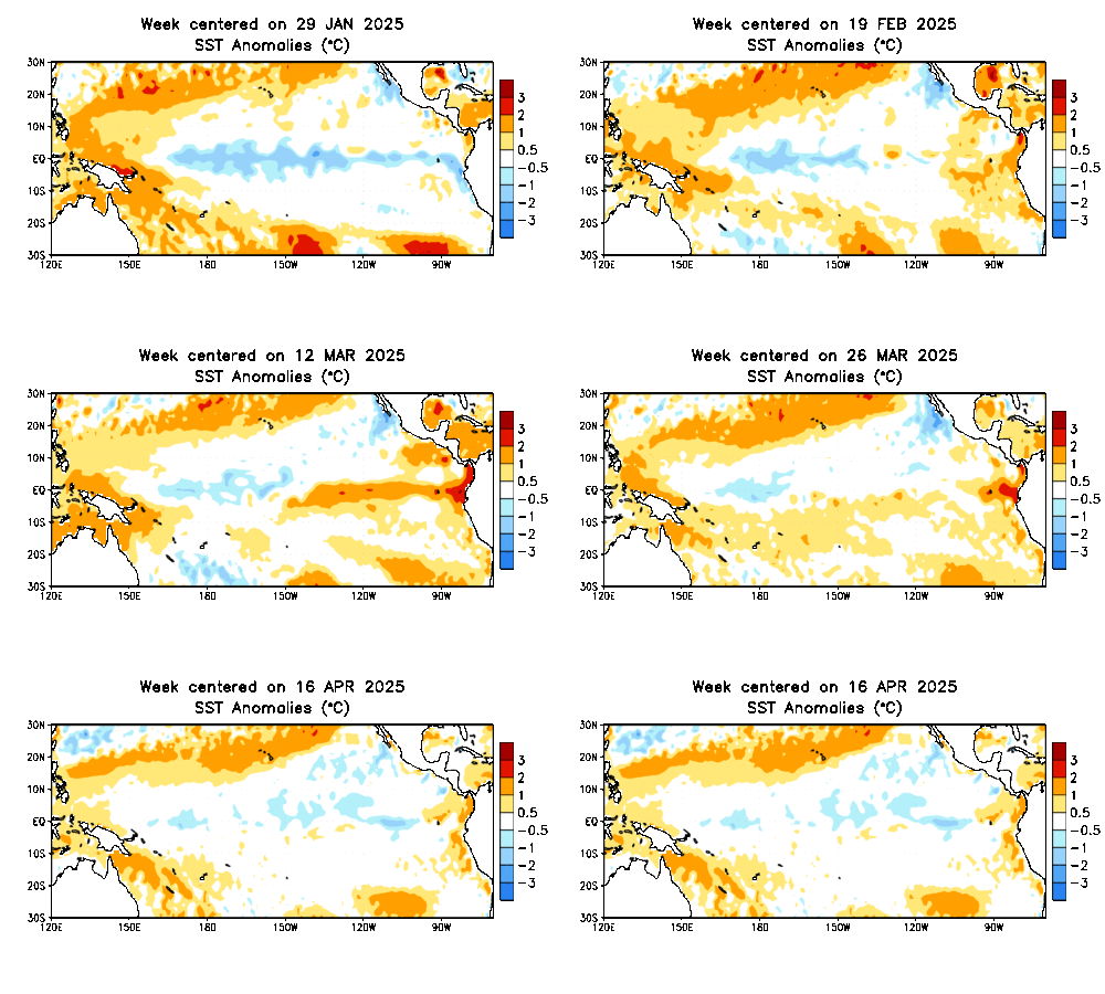
During the last 4-weeks, equatorial SSTs were at least +0.5°C above-average across the equatorial Pacific Ocean and at least +1.0°C in most of the eastern Pacific.
Global SST Departures (°C)

During the last four weeks, equatorial SSTs were above-average in the Pacific and Indian Oceans. North Atlantic SSTs were below average in both the tropics and portions of the high latitudes. Positive SST anomalies now extend along the west coast of North America into the Gulf of Alaska.

Central & Eastern Pacific Upper-Ocean (0-300 m) Weekly Heat Content AnomaliesThe

The upper ocean heat content was below-average across the eastern half of the equatorial Pacific Ocean between mid-August 2008 and March 2009, with a minimum reached in late December 2008. The heat content anomalies have been positive since April, and have steadily increased since that time.
Information on this page is mirrored from ENSO Cycle Report by Climate Prediction Center / NCEP July6, 2009, with some editing by FEWW.
NOAA Press Release:
El Niño Arrives; Expected to Persist through Winter 2009-10
July 9, 2009
NOAA scientists today announced the arrival of El Niño, a climate phenomenon with a significant influence on global weather, ocean conditions and marine fisheries. El Niño, the periodic warming of central and eastern tropical Pacific waters, occurs on average every two to five years and typically lasts about 12 months.
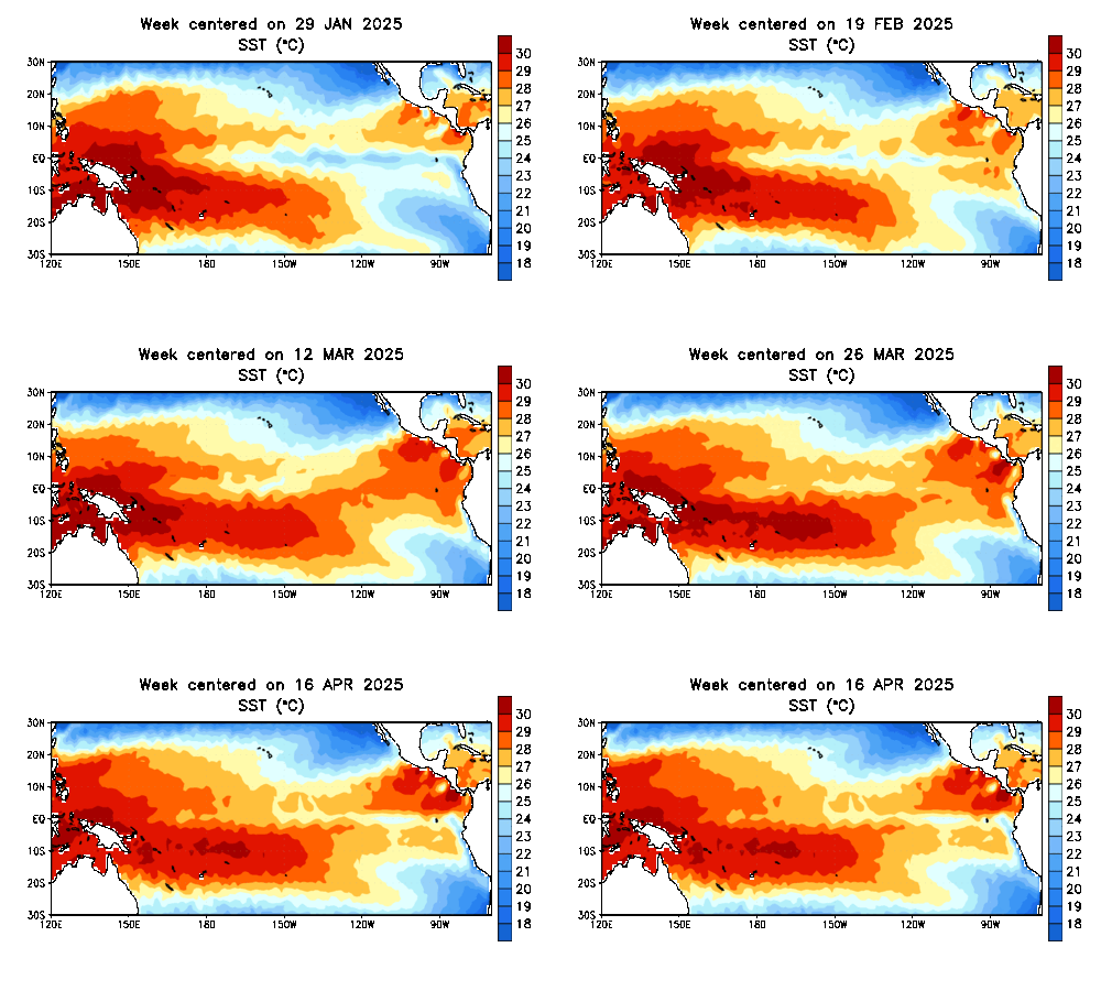
Sea surface temperatures along the equatorial Eastern Pacific, as of July 1, are at least one degree above average — a sign of El Niño. Animation.High resolution (Credit: NOAA)
NOAA expects this El Niño to continue developing during the next several months, with further strengthening possible. The event is expected to last through winter 2009-10.
“Advanced climate science allows us to alert industries, governments and emergency managers about the weather conditions El Niño may bring so these can be factored into decision-making and ultimately protect life, property and the economy,” said Jane Lubchenco, Ph.D., under secretary of commerce for oceans and atmosphere and NOAA administrator.
El Niño’s impacts depend on a variety of factors, such as intensity and extent of ocean warming, and the time of year. Contrary to popular belief, not all effects are negative. On the positive side, El Niño can help to suppress Atlantic hurricane activity. In the United States, it typically brings beneficial winter precipitation to the arid Southwest, less wintry weather across the North, and a reduced risk of Florida wildfires.
El Niño’s negative impacts have included damaging winter storms in California and increased storminess across the southern United States. Some past El Niños have also produced severe flooding and mudslides in Central and South America, and drought in Indonesia.
An El Niño event may significantly diminish ocean productivity off the west coast by limiting weather patterns that cause upwelling, or nutrient circulation in the ocean. These nutrients are the foundation of a vibrant marine food web and could negatively impact food sources for several types of birds, fish and marine mammals.
In its monthly El Niño diagnostics discussion today, scientists with the NOAA National Weather Service Climate Prediction Center noted weekly eastern equatorial Pacific sea surface temperatures were at least 1.0 degree C above average at the end of June. The most recent El Niño occurred in 2006.
El Niño includes weaker trade winds, increased rainfall over the central tropical Pacific, and decreased rainfall in Indonesia. These vast rainfall patterns in the tropics are responsible for many of El Niño’s global effects on weather patterns.
NOAA will continue to monitor the rapidly evolving situation in the tropical Pacific, and will provide more detailed information on possible Atlantic hurricane impacts in its updated Seasonal Hurricane Outlook scheduled for release on August 6, 2009.
NOAA understands and predicts changes in the Earth’s environment, from the depths of the ocean to the surface of the sun, and conserves and manages our coastal and marine resources.
Weekly averaged sea surface temperatures (top, °C) and anomalies (bottom, °C) for the past twelve weeks. SST analysis is the optimum interpolation (OI) analysis, while anomalies are departures from the adjusted OI climatology (Reynolds and Smith 1995, J. Climate, 8, 1571-1583). Credit: CPC/ NWC/ NOAA – http://www.noaanews.noaa.gov/stories2009/20090709_elnino.htmlEL NIÑO/SOUTHERN OSCILLATION (ENSO) – DIAGNOSTIC DISCUSSION
issued by CLIMATE PREDICTION CENTER/NCEP — 9 July 2009 –– click here
Related Links:


Leave a comment