
KILAUEA VOLCANO – HAWAIIAN VOLCANO OBSERVATORY STATUS REPORT
Posted by feww on May 4, 2018
HAWAIIAN VOLCANO OBSERVATORY STATUS REPORT
U.S. Geological Survey
Thursday, May 3, 2018, 10:13 PM HST (Friday, May 4, 2018, 08:13 UTC)
KILAUEA VOLCANO (VNUM #332010)
19°25’16” N 155°17’13” W, Summit Elevation 4091 ft (1247 m)
Current Volcano Alert Level: WARNING
Current Aviation Color Code: ORANGE
The eruption in the Leilani Estates subdivision in the lower East Rift Zone of Kīlauea Volcano that began in late afternoon ended by about 6:30 p.m. HST. Lava spatter and gas bursts erupted from the fissure for about two hours, and lava spread a short distance from the fissure, less than about 10 m (33 ft).
At this time, the fissure is not erupting lava and no other fissures have erupted.
HVO geologists are working near the fissure overnight to track additional activity that may occur, and other scientists are closely tracking the volcano’s overall activity.
Recent Observations
- Sulfur gas is quite noticeable around the fissure…
- Lava flows did not advance more than about 10 m (33 ft) from the fissure. The flows are no longer active.
- No other fissures have erupted from along the rift zone currently.
- Tiltmeters at Kīlauea’s summit continue to record deflationary tilt and the lava lake level has dropped about 37 m (121 ft) in the past 24 hours.
- Seismic activity has not changed significantly during the day or since the brief fissure eruption.
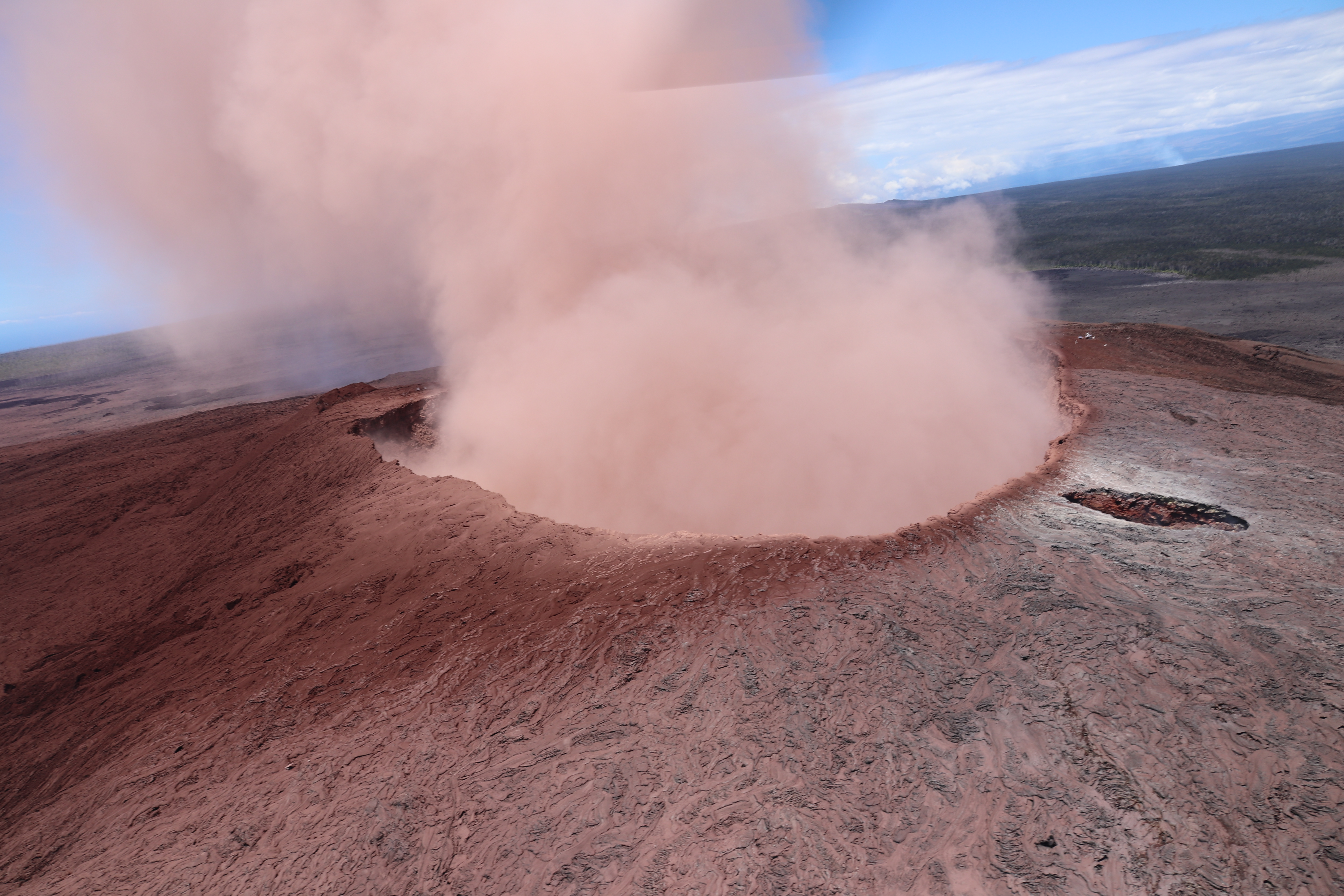
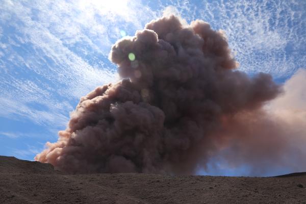
TOP: A view of Pu‘u ‘Ō‘ō from the east, shortly after a small collapse. The coating of red ash on the south side of the cone (left side of photo) is evident. ABOVE: At 10:31 a.m. HST, while HVO geologists were working on Pu‘u ‘Ō‘ō, a magnitude-5.0 earthquake shook the ground around the cone. Moments later, a collapse occurred in the crater of Pu‘u ‘Ō‘ō, creating a robust, reddish-brown ash plume. [Source: volcanoes.usgs.gov]
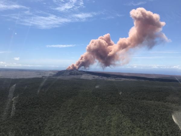
At 10:30 HST (May 3), ground shaking from a preliminary magnitude-5.0 earthquake south of Pu‘u ‘Ō‘ō caused rockfalls and possibly additional collapse into the Pu‘u ‘Ō‘ō crater on Kīlauea Volcano’s East Rift Zone. A short-lived plume of ash produced by this event lofted skyward and dissipated as it drifted southwest from Pu‘u ‘Ō‘ō. Downwind areas may have experienced a dusting of ash from this plume. At this time, the 10:30 earthquake has caused no other changes at Kīlauea Volcano. HVO will continue to closely watch monitoring data for any changes. This image was captured from an HVO overflight carrying HVO scientists to the East Rift Zone for field work today. USGS photo by Kevan Kamibayashi.
SER – 050402
Hawaii M 5.0
19.344°N 155.070°W [18km S of Fern Acres, Hawaii]
6.9 km depth
2018-05-03 20:30:56 UTC

Leave a comment