Fire Earth

Earth is fighting to stay alive. Mass dieoffs, triggered by anthropogenic assault and fallout of planetary defense systems offsetting the impact, could begin anytime!

Archive for the ‘snow forecast’ Category

‘Snow Bomb’ Buries South Korea

Posted by feww on February 14, 2011

South Korea’s north-eastern province of Gangwon receives record snowfall

The biggest snowstorm on century-old record dumps up to 110cm (43.31 inch) of snow in the eastern part of South Korea, burying entire cities.

The ‘snow bomb’ has wreaked havoc in the eastern coastal parts of South Korea. Several hundred houses have collapsed under the weight of the snow, a local newspaper said.

As the South Korean government deployed 12,000 soldiers to help the stranded people, hundreds of schools canceled classes.

“The Gangwon provincial government said it has mobilized about 22,600 in manpower and some 1,750 snowplows and other equipment to clear snow from roads and expressways.” A report said.

Korea’s Meteorological Agency has forecast up to 50 cm (20 inches) more snow by late Monday, the report said.


Image: Yonhap. Image may be subject to copyright.

Posted in snow, snow forecast, snow news, south korea record snow | Tagged: , , , | Leave a Comment »

Western U-S Blasted by Fierce Storm, 2 ft of Snow

Posted by feww on December 31, 2010

Heavy snow blankets a vast area spanning from New Mexico to Minnesota

A winter storm has buffeted the western U-S with violent wind gusts, heavy rain and about 2 feet of snow

More than a million calls forced Arizona highway hotline to shut down after up to two feet of snow blanketed parts of the state.

“We’re expecting almost a one-two punch across the middle part of the country over the next two days.” A National Weather Service forecaster told reporters.

“Once the large-scale pattern sets up you can be very stormy and have one after another.”


Click images to enlarge.


National Snow Analyses –  NOHRSC/NWS/NOAA

Another MOA Storms Brewing Offshore U-S Pacific ?


Click Image to enlarge. Update image.
(24-Hr FE ED). Click HERE to Animate Image. (Source: SSEC/Wisc-Uni)

Snow Cover US (December 31, 2010)

  • Area Covered By Snow: 50.9%
  • Area Covered Last Month: 34.2%

Click Below for 31 Day Animations

Snow Cover Animations:

Related Links:

Other Related Links

European Weather

Posted in snow forecast, snow in the US, snow news, snow storm, winter storm | Tagged: , , , , | Leave a Comment »

Arctic Blast Hits Britain Again

Posted by feww on December 17, 2010

Heavy snow and ice strike many parts of the UK as arctic conditions return

Heavy snow has blanketed Northern Ireland, northern Scotland, Wales and most parts of southwest England, reports say.

More snow is expected in northern Scotland, Northern Ireland, southwest England and Wales. Forecasters say up to 25cm (10 inches) could fall Saturday.

The overnight temperature forecast for parts of Scotland and Northern Ireland is  -10ºC (14ºF).

Thousands of schools are closed across Britain, and snow has blocked a dozen major roads.

Hundreds of flights have been canceled and many more are delayed as at least a dozen airports are shut down. Disruptions are expected at all major airports throughout in England, N-Ireland, Scotland and Wales.

“Heavy snowfall during the past few weeks has caused huge disruption, especially in Scotland and north-east England.” BBC said.

“November saw the UK’s most widespread snowfall since 1965, and December has continued to be exceptionally cold and snowy.”

Many train services are suspended across the country until further notice.

“An estimated two million homes, schools and hospitals face fuel rationing over Christmas after MPs warned that supplies of heating oil would hit “crisis” point during the cold snap,” a report said.

Arctic Oscillation Chills US and Europe


Image depicts the land surface temperatures for December 3-10, 2010, compared to the average temperature for the same period between 2002 and 2009, measured by
MODIS on NASA’s Aqua satellite.  While northern Europe and the eastern United States were cooler than average this year. Greenland and parts of northern Canada, were much warmer due to a temperature pattern caused by the Arctic Oscillation. The Arctic Oscillation is a climate pattern that influences winter weather in the northern hemisphere. It describes the relationship between high pressure in the mid-latitudes and low pressure over the Arctic. When the pressure systems are weak, the difference between them is small, and air from the Arctic flows south, while warmer air seeps north. This is referred to as a negative Arctic Oscillation. Like December 2009, the Arctic Oscillation was negative in early December 2010. Cold air from the Arctic channeled south around a blocking system over Greenland, while Greenland and northern Canada heated up.”  Source: NASA/E-O. Click image to enlarge. Download large image (5 MB, PNG)

Related Links:

Posted in fuel rationing, heating oil shortage, heavy snow in Northern Ireland, Negative Arctic Oscillation, snow forecast | Tagged: , , , , | 3 Comments »

NEW Snowstorm to Hit Upper Midwest

Posted by feww on December 15, 2010

… as  Drought Persists in the South, Southeast

By this time next year, extreme climate could devastate parts of the U-S, leading to famines, epidemics and civil strife

USDA declares parts of 16 states as natural disaster areas due to drought

Drought continues to increase in intensity and coverage across the southern and central Plains,and parts of the southeast,  NWS/CPC forecast.

Drought will persist and expand from central and southern Texas eastward along and near the Gulf Coast through the southern Atlantic Seaboard.

Drought is forecast to also persist in the central and southern Plains, and expand into south-central Nebraska and northwestern Kansas, and from the southern Rockies, central Great Basin into central Nevada… Read full forecast here.

Meanwhile…

NEW Snowstorm pushes  more snow toward the upper Midwest

“Snow will develop today ahead of a storm system dropping down into the Plains. The heaviest snow is expected to fall from central Minnesota down through northeast Iowa and northwest Illinois. 3 to 5 inches of snow is expected to fall over this area by Thursday morning with lesser amounts to the northeast across western Wisconsin.” NWS – Weather Forecast Office.

Related Links:

Posted in Drought, drought an deluge, extreme climate, snow forecast, snowstorm | Tagged: , , , , | Leave a Comment »

Wisconsin Wind Chill Temps to Drop to -33ºC

Posted by feww on December 13, 2010

Wisconsin declares a state of emergency in 72 counties

Wind chill temperatures expected to drop to as low as minus 27 degrees F (- 33ºC).

Gov Jim Doyle of Wisconsin declared a state of emergency in 72 counties as a powerful snowstorm barreled through the upper Midwest depositing about 20 inches of snow, causing extensive power outages, closing many roads in several states and grounding thousands of flights across the region.

The deadly snowstorm which has claimed at least 4 lives so far,  hit Wisconsin and Minnesota first and moved eastward toward Indiana, Iowa, Michigan and Ohio. In Minnesota the roof of the Metrodome in Minneapolis collapsed under about 2 feet of snow.

The National Weather Service has issued a  blizzard warning for Iowa, Minnesota, Wisconsin, Missouri, Chicago, northern, and north-western Illinois, as well as Michigan, North and South Dakota.

“In Wisconsin, wind gusts were as high as 70 miles per hour, the National Weather Service said, and an advisory was issued with wind chill temperatures expected to drop to minus 20 degrees F to minus 27 degrees F (minus 29ºC to minus 33ºC).” A report said.

Pacific Northwest

Extreme rain events in parts of the Pacific Northwest have  triggered major mudslides, closing roads and blocking at least one railroad track in the state of Washington. Forecasters say storms could dump an additional 15cm (6 inches)   or more of rain in the Cascade Range and Olympic Mountains, a report said.

Middle East

Torrential rains, snow, fierce winds and a major sandstorm hit countries across the Middle East and eastern Mediterranean for a second day.  The storms sunk a  cargo ship off the Israeli port of Ashdod and disrupted shipping in the Suez canal and  most Egyptian ports on the Red Sea and the Mediterranean.

A factory collapsed in the port of Alexandria killing at least three people and pushing the reported death toll from climate-related incidents to at least 6 in the region so far.

U.S Weather Outlook


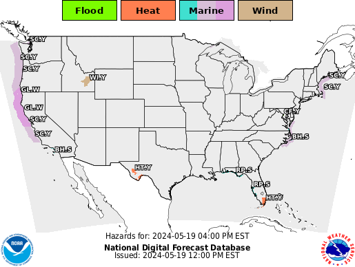
Click image to update.
Click HERE to Animate.


National Weather Service. Click image to enter portal.

Related Links:

Posted in midwest snowstorm, snow forecast, snow in the US, snowstorm, state of emergency | Tagged: , , , , | Leave a Comment »

Pacific storm moves across the Northwest

Posted by feww on January 1, 2010

Pacific storm causing heavy rain and snow from Washington and Oregon to Intermountain West

A Pacific storm  in the Northwest is generating heavy rain and high-elevation snow as it moves from  the coast of Washington and Oregon to the Intermountain West.

The cold front is moving also southward  (see image above) into N. Calif, with rain and high-elevation snow expected as far south as the San Francisco Bay Area.

Near Real Time US Composite Satellite Image

Click HERE to Animate Above Image

Predominant Weather


GOES West Unenhanced Satellite Image

Click image to enhance, update  and animate

Weather Forecast

GOES Infrared Image for North America
6Hr Precipitation Accumulative Amount  (in)

Posted in Northwest storm, rain forecast, SF Bay Area forecast, snow forecast, snow storm | Tagged: , , , , | 3 Comments »