Fire Earth

Earth is fighting to stay alive. Mass dieoffs, triggered by anthropogenic assault and fallout of planetary defense systems offsetting the impact, could begin anytime!

Posts Tagged ‘Severe Thunderstorms’

More Severe Thunderstorms, Rain and Flash Flooding

Posted by feww on May 11, 2011

BREAKING:

Weather Forecast Map


Click images to enlarge.

GOES Eastern US SECTOR Infrared Image

Fire Weather Outlook

From:   2011 Disaster Calendar – MAY 
  • Day 496 [May 11, 2011]
    • Tennessee, USA. The White House has declared Shelby and  14 other Tennessee counties disaster areas following the damage caused by rising Mississippi River and extreme weather events that have buffeted the region since mid April, reports say.
    •  Minnesota , USA. The White House has declared 20 counties in both the Red River Valley and southern Minnesota federal disaster areas because of widespread flooding and severe  storms in March that wreaked havoc in the state, a report said.
    • Missouri, USA. The White House has declared five Missouri counties major disaster areas, following devastation from tornadoes, storms and flooding. “Property owners who’ve gone into the Mississippi River Floodway say the situation is bad.” Said a report.

Related Links

Global Mega Disasters

Posted in 2011 disaster forecast, 2011 disasters, extreme weather | Tagged: , , , , , | Leave a Comment »

Another Round of Extreme Weather Looms

Posted by feww on April 20, 2011

‘Strong severe weather’ for southern Plains across the Mississippi Valley and southern Great Lakes into the Midwest: NWS

On March 1, 2011, FIRE-EARTH forecast

U-S Attacked by Continued Severe Weather

Brace for the Worst Ever!  Climatic  Extremes, Primeval Geophysical Activities and WILD Weather to Wreak Mega Havoc in 2011/2012 and Beyond …

NOW IS THE PERFECT TIME TO POWER DOWN AND START THINKING HARD.

Encourage your folks, friends and neighbors to join in!! BECAUSE  for most of us the GAME would be OVER soon.

Flooding and fires, earthquakes and volcanic eruptions, deadly tornadoes and strong storms … are just some of the items you’ve ordered from the climate change quick menu!

U.S. Weather Hazard Map


Click image to enter NWS portal.

“A 7-state area at Moderate Risk for severe weather is surrounded by a core of 14 states at Slight Risk that stretches from northeast Texas to western Pennsylvania and New York.” NWS reported.

Weather Forecast Map

Weather Extremes Today

  • Large area of severe weather is forecast
  • Heavy snow probability in most of North Dakota, N and NW South Dakota, S. Minnesota, Wisconsin, N Iowa
  • Rain and thunderstorms over the central Plains
  • Snow in the mountain areas of the west

Wilmington, OH Radar


Click image to enlarge. Click HERE to update.

SPC Storm Reports


Latest report. Click images to enlarge 


Tuesday


Monday

Public Severe Weather Outlook

Widespread severe thunderstorms are forecast for parts of the Ozarks, the lower and middle Mississippi Valleys, and the lower Ohio Valley through tonight: Read SPC forecast.

Probability of Tornadoes – click images to enlarge

Probability of a tornado within 25 miles of a point.
Hatched Area: 10% or greater probability of EF2 – EF5 tornadoes within 25 miles of a point.

Probability of Hail

Probability of hail 1″ or larger within 25 miles of a point.
Hatched Area: 10% or greater probability of hail 2″ or larger within 25 miles of a point


Probability of damaging thunderstorm winds or wind gusts of 50 knots or higher within 25 miles of a point.
Hatched Area: 10% of greater probability of wind gusts 65 knots or greater within 25 miles of a point.


Convective Outlook.

Related Links


Posted in Severe Weather Outlook, Tornado Outbreak, U.S. Weather Map | Tagged: , , , , , | Leave a Comment »

Severe Thunderstorms Brewing

Posted by feww on April 19, 2011

US Weather Update

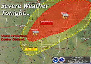
Severe thunderstorms forecast for parts of the Ozarks, the lower and middle Mississippi Valleys, and the lower Ohio Valley later today through tonight: NWS

Tornadoes, damaging winds and large hail developing in the Ozarks will move  into parts of Mississippi and lower Ohio Valleys later today through tonight: NWS Storm Prediction Center forecasts

Most likely target areas:

  • Northern And Western Arkansas
  • Central And Southern Illinois
  • Central And Southern Indiana
  • Western And Northern Kentucky
  • Southern And Eastern Missouri
  • Western Ohio
  •  Eastern Oklahoma
  • Northwest Tennessee

Severe Weather Forecast Map


Click image to enlarge. Click HERE to update

See earlier entry at

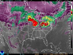
GOES Eastern US SECTOR Infrared Image 

Image of the Day: The Angry Storm Face


Click image to enlarge. Click HERE to update


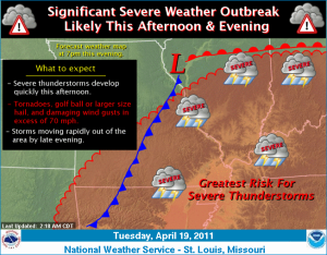
‘Severe thunderstorms are expected to rapidly develop over Missouri and Illinois this afternoon and spread quickly east this evening. The strongest storms will be capable of producing tornadoes, golf ball or larger size hail, and damaging straight line wind gusts in excess of 70 mph. Locally heavy rainfall is also possible. The storms are expected to exit the region to the east by late evening.’ NWS said.


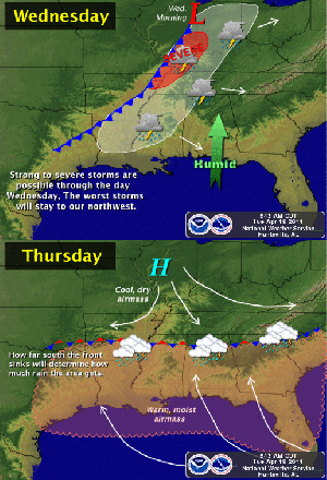
“A cold front will move into the area on Wednesday and bring a good chance for thunderstorms.  Some of these storms could be strong to severe, but the better chance for more organized severe thunderstorms will be to the northwest of our area. The front will stall in our area on Thursday, with the possibility for showers and thunderstorms lingering through the period and perhaps into the weekend,” NWS said.

More information available at NWS …

Related Links

Posted in National Weather Forecast, US Storm Map, US storms, us weather forecast, US Weather Map | Tagged: , , , , , | Leave a Comment »

Tornadoes, Severe Thunderstorms, Heavy Snow

Posted by feww on April 15, 2011

“A very active weather day,” NWS forecast

SEVERE THUNDERSTORMS EXPECTED OVER PARTS OF THE SOUTH-CENTRAL PLAINS

The NWS Storm Prediction Center in Norman OK has forecast the development of

  • Strong Tornadoes
  • Very Large Hail
  • Damaging Winds

Areas most likely to experience this activity include

  • W Arkansas
  • SE  Kansas
  • Extreme SW Missouri
  • E  Oklahoma
  • Extreme NE Texas

Severe storms also possible from the central Plains to the Mid-South.


Click image to enter NWS portal.

“A disturbance will emerge from the Four Corners region to the southern and central High Plains this afternoon, where it will begin a rapid intensification as it is fed by a strong surge of moisture from the Gulf of Mexico. Strong to severe thunderstorms are expected in the south-central Plains today with a strong possibility of tornadoes, large hail and damaging winds. Heavy rainfall is also possible.” NWS said.


Little Rock, AR,  Base Reflectivity Radar. Click image to enlarge. Click here to update.


Click image to enlarge.

TEXAS Wildfires

Meanwhile, large wildfires continue to burn across portions of Texas. As of posting, 33 states are helping Texas to fight some 21 large to major wildfires.


Picture of the Swenson fire in Stonewall County taken on April 7, 2011.  Photo is courtesy of the Texas Forest Service.

Related News Links

Related Link

Posted in extreme weather, Extreme weather events, SEVERE WEATHER, US weather | Tagged: , , , , , | Leave a Comment »