Fire Earth

Earth is fighting to stay alive. Mass dieoffs, triggered by anthropogenic assault and fallout of planetary defense systems offsetting the impact, could begin anytime!

Posts Tagged ‘BP oil disaster’

FIRE halts BP oil production at Valhall platform, North Sea

Posted by feww on July 15, 2011

Valhall oil platform evacuated, production suspended indefinitely

The fire, which started in a compressor on the platform at 15:00UTC, forced BP to evacuated 638 workers and shut down the platform, according to NRK, the Norwegian state broadcaster.

“No persons are injured and no one is missing,” BP spokesman Jan Erik Geirmo told NRK. “We see this as a serious incident.”

“How it was ignited, we have no idea,” he said. “If any place should burn, it was one of the best places for it to happen. It had no big potential to escalate. But a fire is a fire.”

Valhall oil field is located at a depth of about 70 meters in the Norwegian sector of the North Sea some  290 km (180 miles) off southern Norway. Discovered in 1975, the oil field became operational in 1982.

Valhall has a total production capacity of about 180,000 bpd, however it was only producing about  42,000 bpd before the fire because, according to BP, the platform was old.

Hess, a New-York listed company is the majority owner of Valhall oil field with a 64 percent share, with  operator BP holding 36 percent.


Valhall Oil Platform Complex. Source BP. Click image to enlarge.

Related Links

Posted in environment | Tagged: , , , , , , | Leave a Comment »

Massive Coral Die-Off

Posted by feww on November 7, 2010

Massive deep-sea coral die-off found near BP oil disaster source in GOM

Large colonies of bottom-dwelling coral were found covered in a black substance, most probably crude oil, at a depth of about 1,400m (4,600 feet) near the damaged Macondo wellhead, NOAA scientists said.


This dying coral was found covered in a dark substance, near the damaged Macondo wellhead. Could it be oil from the BP oil disaster in GOM? Image source: NOAA

“Corals do die, but you don’t see them die all at once,” said cruise lead scientist Charles Fisher of Penn State University. “This … indicates a recent catastrophic event,” he told National Geographic News.

“The proximity of the site to the disaster, the depth of the site, the clear evidence of recent impact, and the uniqueness of the observations all suggest that the impact we have found is linked to the exposure of this community to either oil, dispersant, extremely depleted oxygen, or some combination of these or other water-borne effects resulting from the spill,” Fisher said.

Related Links

Posted in 2010 disasters, 2011 disasters, Oil Disasters, oil pollution | Tagged: , , , , , | Leave a Comment »

Proteobacteria Don’t Burp?

Posted by feww on August 25, 2010

BP GOM Oil Plumes Spinning Out of Sight

Fast-eating species of microbes ate a Manhattan-sized oil plume spewed from BP Macondo well: Report

REALLY? DID THEY EAT THE DISPERSANTS, TOO?

“The micro-organisms were apparently stimulated by the massive oil spill that began in April, and they degraded the hydrocarbons so efficiently that the plume is now undetectable, said Terry Hazen of Lawrence Berkeley National Laboratory,” according to a dubious report.

IF YOU DON”T BELIEVE IT SEE PHOTO BELOW!!

Which one of you greedy guys ate all the oil?


Original caption: This undated handout image shows microbes (C) degrading oil (upper right) in the deepwater plume from the BP oil spill in the Gulf, a study by Berkeley Lab researchers has shown. Credit: Reuters/Hoi-Ying Holman Group

Is this serendipstickity or what? How about another  “independent” report to back this fantastic news up?

WORRY NOT! The intrepid NOAA scientists, having started a 3-week mission on August 18,  are conducting their Operation Dip**** [Dipstick.]

“We’re looking for hydrocarbons to see how things in the deepwater column are changing,” Tom Weber, chief scientist aboard the 35-meter boat Pisces, said. “Ever since the well has been capped, we haven’t seen that much.”

REALLY?

So the other scientists who don’t work directly for the govt must be lying!!!

University of Georgia researchers have reported that more than 75 percent the oil from the Macondo well disaster still lurks below the water in the Gulf of Mexico and threatens the ecosystem.

Related Links:

Posted in dead zone, environment, Lawrence Berkeley National Laboratory, Macondo well, Proteobacteria | Tagged: , , , , | Leave a Comment »

Deadly Oil Continues to Gush in the Gulf – Satellite Images

Posted by feww on July 12, 2010

Gulf of Mexico Oil Disaster : Day 83


Oil from BP’s damaged Macondo oil well floats on  the Gulf of Mexico. MODIS on NASA’s Terra satellite captured this natural-color image on July 11, 2010. A particularly bright patch of oil is seen  appears southeast of the Mississippi Delta, close to the location of the sunken Deepwater Horizon oil  rig. Source: NASA E/O.
Click image to enlarge. Download large image (4 MB, JPEG)

Related Links:

Posted in Deepwater Horizon, Deepwater Horizon Oil Slick, gulf of mexico oil leak, Gulf of Mexico oil Spill, Gulf of Mexico oil Spill satellite photo | Tagged: , , | Leave a Comment »

Gulf of Mexico: Different Shades of Crude Oil

Posted by feww on July 6, 2010

Could it Get any Worse?

Yes, it probably could!

Growing Oil Slick in the Gulf of Mexico


Oil from BP’s damaged Macondo oil well (Deepwater Horizon platform) swamps the Mississippi Delta on July 4, 2010. Natural-color image captured by MODIS on NASA’s Terra satellite. Source: NASA E/O.  Click image to enlarge. Download large image (4 MB, JPEG)

Related Links:


Posted in gulf of mexico oil leak, Gulf of Mexico oil Spill, Gulf of Mexico oil Spill satellite photo, Gulf Oil Disaster, Macondo well | Tagged: , , , , | Leave a Comment »

Mississippi Barrier Islands Attacked by Oil Slick

Posted by feww on June 30, 2010

Mississippi Barrier Islands and Gulf Coast Satellite Images


Petit Bois Island is 10 km (6 miles) long and is  is one of 7 barrier islands included in the Gulf Islands National Seashore.
“As of June 27, 2010, the entire gulf-facing beachfront of several barrier islands in eastern Mississippi (offshore of Pascagoula) had received a designation of at least “lightly oiled” by the interagency Shoreline Cleanup Assessment Team that is responding to the disaster in the Gulf of Mexico. A few small stretches of Petit Bois Island had been labeled heavily or moderately oiled.” Image acquired by ALI on NASA’s EO-1 satellite on June 26, 2010. Source: NASA E/O. Click image to enlarge. Download large image (3 MB, JPEG)

Related News:

Oil from a BP Plc spill in the Gulf of Mexico washed ashore at one of the largest tourist beaches in Mississippi on Monday, forcing tourists to pack their bags and evacuate the shore.

Related Links:


Posted in 2010 disasters, gulf of mexico oil leak, Gulf of Mexico oil Spill, Gulf of Mexico oil Spill satellite photo, Gulf Oil Disaster | Tagged: , , , , | Leave a Comment »

BP Oil Disaster – Latest Satellite Images

Posted by feww on June 28, 2010

Oil Slick Continues to Spread Like Malignant Cancer

Large patches of thick oil washes ashore in Mississippi for the first time: Report


Gulf of Mexico Oil Disaster. Oil from BP’s leaking Macondo oil well I seen spreading in this natural-color acquired  by MODIS on NASA’s Terra on June 25, 2010. Source: NASA. Click image to enlarge. Download large image (883 KB, JPEG)

Oil from BP’s leaking Macondo well has washed ashore  at Ocean Springs beaches, about 15 km (9 miles) east of Biloxi, Mississippi, and at another beach close to an inland marsh, reports say.

“We cannot clean up or catch the oil until BP gets here. They have all of our people,” said Earl Etheridge, a spokesman for Mississippi’s Department of Environmental Quality, Reuters reported.

Sanitized images and writeup are available at the following sites:

Related Links:

Posted in Deepwater Horizon, gulf of mexico oil leak, Gulf of Mexico oil Spill, Gulf of Mexico oil Spill satellite photo | Tagged: , , , | Leave a Comment »

Gulf of Mexico Oil Disaster: Headline News

Posted by feww on June 26, 2010

1. As BP stock plunges to a 14-year Low, UK PM fears the firm’s “destruction”

“It is also in all our long-term interests that there is some clarity, some finality, to all of this, so that we don’t at the same time see the destruction of a company that is important for all our interests,” UK PM David  Cameron told Canadian broadcaster CBC.

2. Gulf braces for storm, halt to oil containment

“Federal officials Friday say a tropical storm or hurricane in the Gulf of Mexico could shut down spill-containment operations at BP’s leaking oil well for two weeks, a report said.

3. Govt asks appeals court to keep deepwater drilling ban

Enemy of Earth Judge Feldman had ordered the moratorium be lifted because he decided it was “too broad” and did not justify the impact on the economy. “On Thursday, he denied a stay request by the Obama administration.

4. BP oil spill: Suicide of fisherman ‘distraught at spill’

“Captain William Allen-Kruse was found dead with a gun on board his boat by fellow workers. Coroner Stan Vinson told US media that witnesses believe Mr Kruse, who had been a charter boat fisherman for 20 years, had been distraught at the spill.”

Related Links:

Posted in Gulf of Mexico oil Spill, Gulf of Mexico oil Spill satellite photo, Gulf of Mexio, Gulf Oil Disaster | Tagged: , , , , , | 1 Comment »

Black Rain in Louisiana?

Posted by feww on June 24, 2010

Raining Crude Oil in Louisiana?

Shocking video, filmed in River Ridge, near New Orleans shows visible sheen gathering in the puddles after a recent rainfall in the area. The filmmaker says the residue is “thick,” “foamy,” and “smells like the oil.”

Related Links:


Posted in Deepwater Horizon Oil Slick, gulf of mexico oil leak, Gulf of Mexico oil Spill, oily rain River Ridge, River Ridge | Tagged: , , , , | 1 Comment »

Gulf of Mexico in BP Crosshairs

Posted by feww on June 24, 2010

Oil in GOM: 4.2 Million Barrels and Rising

Undersea remote control vehicle (RCV) damages the ruptured wellhead’s “vent system”

Oil gushed unhindered from BP’s ruptured wellhead after an undersea RVC collided with a makeshift vent system placed above the wellhead to capture some of the crude from the world’s deadliest oil spill. [Watch this space.]


Oil Continues to gush out of the BP’s Black Death Oil Well at a rate of about 69,000bpd (±16 %).

News Links:

Related Links:


Posted in gulf of mexico oil leak, Gulf of Mexico oil Spill, Gulf Oil Disaster, gulf oil spill site | Tagged: , , , | Leave a Comment »

Methane in Gulf Million Times Above Normal

Posted by feww on June 23, 2010

Methane gas is up to 1 million times higher than the normal level near the Gulf of Mexico oil spill:  U.S. Researchers

Such incredibly high levels of methane could deplete oxygen and create a larger than usual dead zone in Gulf of Mexico.

An oceanography professor at Texas A&M University, who spent ten days researching the water quality near the BP Plc oil spill in the gulf, says methane gas levels in some areas close to the spill source are “astonishingly high,” a report said.

“There is an incredible amount of methane in there,” Kessler said, noting that his team of 12 researchers has found concentrations of methane that were 100,000 times higher than normal within an 8 km (5-mile) radius of BP’s ruptured wellhead.

“We saw them approach a million times above background concentrations” in some areas, Kessler said.

“At some locations, we saw depletions of up to 30 percent of oxygen based on its natural concentration in the waters. At other places, we saw no depletion of oxygen in the waters. We need to determine why that is,” he added.

The oxygen depletion are still above a critical level, he said, but the oil still leaking into the Gulf, at about 60,000 barrels per day.

“What is it going to look like two months down the road, six months down the road, two years down the road?”

The researchers believe measuring the methane level could provide a more accurate estimate of the rate of oil spill, and are hoping to have their own estimate soon.

“Give us about a week and we should have some preliminary numbers on that,” he said.

Related Links:

Posted in Deepwater Horizon Oil Slick, gulf of mexico oil leak, Gulf of Mexico oil Spill, Oceanography, Oil Disasters | Tagged: , , , , | 5 Comments »

BP ‘Top Kill’ Dead

Posted by feww on May 30, 2010

‘Top Kill’ Had Less Than Zero Percent Chance of Succeeding

But, it was a psychological game to re-establish the power domains and send a clear message as to who was actually in charge.

“We have not been able to stop the flow. We have made the decision to move on to the next option,” said Doug Suttles, BP Exploration and Productions chief operating officer in the U.S.

Image of the Day:


Redfish Bay in Louisiana’s birdsfoot delta turns black, May 27, 2010. Source: Gulf Restoration Network Handout (via Reuters).

Collapse Survivors Note:
The ultimate ethical expression would be to neutralize the politicians, industry executives and their chains of command responsible for crimes against nature. Corrective action against the wrongdoers should not be viewed as acts of “revenge,” or “punishment,” but as a necessary means of preventing repetitions of similar crimes.

Related Links

Posted in Collapse Survivors, Deepwater Horizon, gulf of mexico oil leak, Gulf of Mexico oil Spill, Gulf of Mexio | Tagged: , , , , | 2 Comments »

Gulf Oil Disaster – Image of the Day

Posted by feww on May 29, 2010

World Govt, Big Oil, ‘Economy,’ Energy…

Any other outcome would be an aberration


An aerial view of the marshes nearthe coast of Louisiana, May 27, 2010. Greenpeace handout (Via Reuters).

For an assessment of the role of Greenpeace in the environmental issues, and their relationship with BP search blog contents.

Related Links:

Posted in Deepwater Horizon, Deepwater Horizon Oil Slick, gulf of mexico oil leak, Gulf of Mexico oil Spill | Tagged: , , , | 1 Comment »

BP Oil Spill: Turtles Are Dying

Posted by feww on May 19, 2010

More Turtles Are Dying Than Before Oil Leak: Experts

At least 156  dead or dying sea turtles have been found along the U.S. Gulf Coast since April 30, some 10 days after the Deepwater Horizon oil rig exploded.

This number of dead or dying turtles that have been washed up along the coasts of Alabama, Florida Louisiana and Mississippi is greater than the number of dead and injured  turtles that that we expect to see this time of the year, said Dr. Michael Ziccardi, a veterinarian and  director of the Oiled Wildlife Care Network in California.

“The toll among sea turtles has been steadily rising since the deep-sea well ruptured last month, and the stranding count began to reach an unusually high level in the past week,” Ziccardi was reported as saying.

In Gulf of Mexico: A Waiting Disaster

Moderators introduced the Thunder Horse platform, the world’s largest semisubmersible facility, as another likely candidate that might cause another oil spill mega disaster in the Gulf of Mexico.

Which of the Gulf of Mexico’s Deepwater Wells Would Leak Next?


Located 150 miles (241 kilometers) southeast of New Orleans in Mississippi Canyon Block 778 in a water depth of approximately 6,050 feet (1,844 meters), the Thunder Horse platform is the world’s largest semisubmersible facility. British Petroleum received approval from the Minerals Management Service to debottleneck the topside production facilities to 275,000 barrels of oil and 220 million standard cubic feet of natural gas per day. As of March 20, 2009, production was approximately 260,000 barrels of oil and 210.5 million standard cubic feet of natural gas per day from seven wells. The Thunder Horse Field is the largest producer in the Gulf of Mexico. (Image courtesy of BP America Inc.). Source: DOI, MMS Report. Mississippi Canyon Block 778 could turn out to be another “Challenger” of deepwater oil production.


In 2005 Hurricane Dennis forced the crew to evacuate Thunder Horse, which was later found listing when the crew returned.Source: USGC.

The Atlantis

Blog Moderators have since learned that the U.S. government has decided to investigate another big BP oil rig, the Atlantis.

Atlantis PQ is believed to be a BP plc/BHP Billiton joint venture deepwater semi-submersible oil platform which is located over the Green Canyon Atlantis Oil Field in Gulf of Mexico, about 300 km (185 mi) south of New Orleans.


The Atlantis PQ oil and gas production platform is the  deepest moored oil and gas extraction facility in the world producing about 200,000bpd.  BP is the majority shareholder with 56 percent of the oil field while BHP owns the remaining 44 percent. Image is a BP copyright and is included here for educational purposes.

Growing Oil Slick in the Gulf of Mexico


Nearly a month after a deadly explosion at the Deepwater Horizon oil rig, the damaged well on the bottom of the Gulf of Mexico continued to spill oil. In the weeks since the accident occurred, the oil slick has periodically drifted northeast toward the Mississippi Delta and reached the the Chandeleur Islands. On May 17, 2010, when the Moderate Resolution Imaging Spectroradiometer (MODIS) on NASA’s Terra satellite acquired this natural-color image, a large patch of oil was visible near the site of the accident, and a long ribbon of oil stretched far to the southeast. Image and [edited] caption: NASA E/O. Download large image (1 MB, JPEG) Click image to enlarge.

Related Links:

.

Serial No 1,742. Starting April 2010, each entry on this blog has a unique serial number. If any of the numbers are missing, it may mean that the corresponding entry has been blocked by Google/the authorities in your country. Please drop us a line if you detect any anomaly/missing number(s).

Posted in environment, gulf of mexico oil leak, Gulf of Mexico oil Spill, Gulf of Mexico oil Spill satellite photo | Tagged: , , , | 4 Comments »

BP Oil Leak: Mega Disaster Enters New Dimension

Posted by feww on May 19, 2010

Oil Spill Expected to Enter Gulf Stream

The oil leak from Deepwater Horizon ruptured wellhead is closing in on a  circulating current in the Gulf of Mexico called the Loop Current, and it’s feared that it will enter the Gulf Stream possibly by early next week.

The University of South Florida College of Marine Science Ocean Circulation Group (OCG/CMS/USF) has prepared  a video showing the trajectory of the oil spill (4 -8 May) and the how the Gulf currents are being impacted.  See animation update here (18 – 21 May 2010).

Trajectory of the oil spill – Actual and Forecast (OCG/CMS/USF)


Click Here to See Animation

Projected Movement of BP oil spill in the Gulf of Mexico (4 – 8 May 2010)

New Lawsuit Targets Federal Officials

The environmental law firm Earthjustice has  filed a new lawsuit on behalf of Gulf Restoration Network seeking to reverse what it called an illegal waiver of safety regulations, which was granted to BP (It also covered other oil companies drilling off the coasts o Alabama, Louisiana and Mississippi) in 2008 and runs through 2013.

The suit names Interior Secretary Ken Salazar, Assistant Interior Secretary Wilma Lewis and the MMS Director Elizabeth Birnbaum as plaintiffs, and is one of at least 10 dozen various suits filed against BP Plc.

To Earthjustice Law Firm: How much more evidence of corruption and/or incompetence will you need to sue the entire U.S. Administration out of office? Please respond!

Related Links:

Serial No 1,740. Starting April 2010, each entry on this blog has a unique serial number. If any of the numbers are missing, it may mean that the corresponding entry has been blocked by Google/the authorities in your country. Please drop us a line if you detect any anomaly/missing number(s).

Posted in gulf of mexico oil leak, Gulf of Mexico oil Spill, Ken Salazar, Loop Current, MMS waiver | Tagged: , , , , | 2 Comments »

BP Leak Already Biggest Oil Disaster in U.S. History

Posted by feww on May 18, 2010

About 1.4 million barrels of crude may have already spewed into the Gulf of Mexico

[NOTE: Fire-Earth estimate for the amount of crude oil already leaked into GOM is about 700,000 barrels as of May 18.]

BP oil disaster in the Gulf of Mexico has already exceeded by a factor of 2.5 to 5 the magnitude of Exxon (Exxon Valdez) disaster in Prince William Sound, on the south coast of Alaska in 1989.

In the Exxon Valdez disaster an estimated 11 million gallons (262,000 barrels) of crude oil were released into the Alaskan waters. An estimated 30,000 gallons of crude still remains in the sand and soil.

Even at NOAA’s hugely underestimated calculation of 5,000bpd, the spill total now stands at 140,000 barrels (6 million gallons and counting).

Oil disasters are usually measured in terms of how many barrels of oil are spilled into the waters; however, the plight of so many millions of people whose livelihood depends on what was already an ailing body of water, has added a new socioeconomic dimension.

What BP Says:

BP Plc says its “quick fix” is sort of working. Using undersea remote control devices [‘robots,’]  their technicians have inserted a mile-long tube into the leaking riser, the  massive ruptured pipe, and are  siphoning about a fifth of the oil that is gushing out of the well.


GULF of MEXICO – Gas from the ruptured Deepwater Horizon wellhead is flared by the drillship Discoverer Enterprise May 16, 2010. A fraction of the gas and oil from the wellhead are being brought to the surface via a narrow siphoning tube that was placed inside the much wider damaged riser. U.S. Coast Guard photo by Petty Officer 3rd Class Patrick Kelley. [Caption edited by FEWW]

“I do feel that we have, for the first time, turned the corner in this challenge,” BP Chief Executive Tony Hayward said in Florida.

“Over the last 48 hours, we’re beginning to meet with some significant success.”

Clearly the criteria for success in BP minds is different to the rest of us. WE see the leak as still continuing.

Center for Public Integrity has released a new paper that shows 2 of the BP-owned U.S. refineries were responsible for 97 percent of the worst refining industry safety violations in the past three years, according to federal inspectors.

Let the federal inspectors call it safety violations, what BP has done in the Gulf of Mexico is corporate terrorism.

The suspected terrorist who left a car in New York’s Time Square recently which reportedly contained propane gas cylinders, which may or may not have exploded, and may or may not have killed anyone, would probably spend the rest of his life in a federal prison.

BP executives who have already killed 11 people, devastated at least twice as many families and left a number of orphans behind, on the other hand, are walking freely and discussing their next deepwater drilling project.

How Badly is Louisiana Affected?

Meanwhile, hundreds of shrimpers in Louisiana as well as many others whose income depends on fishing, tourism and related industries, have already lost their jobs, and are barely surviving, making ends meet by doing odd jobs where available.

And Florida?

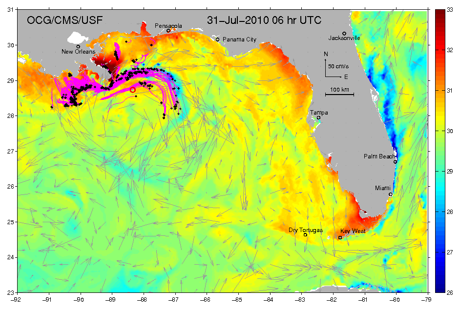
US Coast Guard  Rear Adm Peter Neffenger is on record as saying that the oil could be swept up into the “loop current” and move around Florida coastline.

“Currently it shows to be somewhere in the neighborhood of 40-50 miles [65km-80km] from the southern edge of the spill,” he said.

“We are watching that carefully and as a result of that we are preparing for potential impact on the southern Florida coast and impacts around the southern Florida coast.”

Related Links:

Serial No 1,738. Starting April 2010, each entry on this blog has a unique serial number. If any of the numbers are missing, it may mean that the corresponding entry has been blocked by Google/the authorities in your country. Please drop us a line if you detect any anomaly/missing number(s).

Posted in disaster 2010, Exxon Valdez, exxon valdez oil spill, gulf of mexico oil leak, Gulf of Mexico oil Spill | Tagged: , , , , | Leave a Comment »

Nightmare Plume and ‘Cozy Relationship’

Posted by feww on May 16, 2010

Wondered where all the oil spill was?

If you have been reading this blog, or listening to experts describing the daily ration of oil spewing into the Gulf as being much larger than reported by  NOAA, and jumped on by BP, you must have wondered what could have happened to the oil.

Wonder no more! Scientists have discovered  massive oil plumes in the Gulf including one measuring 10 miles by 3 miles by 300 feet thick, according to New York Times.

To put the measurement into some prospective, a plume measuring as described above would be very large, indeed, and supports our earlier estimates that the at least 25,000bpd of crude oil was gushing out of the ruptured pipe.

Meanwhile, BP admitted that its latest attempt to stop the leak, by threading a much narrower 6-in (15-cm) tube inside  a 21-inch (53-cm) riser-pipe, to funnel the oil to a vessel at the surface had failed.

A company spokesman said, they would try again.

Meanwhile, the British newspaper Guardian reported BP Chief Executive Tony Hayward  as saying that the size of the spill was “tiny” compared to how large the he Gulf of Mexico was.

Cozy Relationship Or Federal Felony

Readers would recall that President Barrack Obama declared that  the epoch of  “cozy relationship” between oil firms and US regulators was over.

“For too long, for a decade or more, there’s been a cozy relationship between the oil companies and the federal agency that permits them to drill,” Obama said.

“That cannot and will not happen anymore,” Obama added.…

What the President failed doing was to define the exact meaning of a “cozy relationship.” Was it about the oil executive and MMS officials sharing a joint together, swapping sexual partners and doing each other a few “harmless” favors, or was it about breaking the law and committing a federal felony?

Environmental group suing U.S. Govt over oil permits

The Center for Biological Diversity, an environmental group, has filed a notice of intent to sue Ken Salazar the U.S. Interior Secretary, and the Interior Department’s Minerals Management Service (MMS) for failing to get the necessary environmental permits, required by two environmental laws, the Marine Mammal Protection Act, and the Endangered Species Act, before approving offshore oil operations.

Note, the key words and phrases here are, “failing to get the necessary environmental permits,” the Endangered Species Act and “the Marine Mammal Protection Act.” and

“The Marine Mammal Protection Act and Endangered Species Act prohibit private entities, such as oil companies, as well as federal agencies, such as the Minerals Management Service — the branch of the Interior Department responsible for managing offshore oil activities — from killing, harming, or harassing marine mammals, unless they have received authorizations and take measures to minimize the impacts of their activities. The Endangered Species Act protects species such as the sperm whale, which is listed as endangered, while the Marine Mammal Protection Act applies to all marine mammals, such as the bottlenose dolphin and the Florida manatee.” The group said in their notice.

Lawsuit to Challenge Salazar’s Wholesale Disregard of Marine Mammal Protection Laws in Gulf of Mexico: 400-plus Oil Projects Illegally Approved by Salazar Without Permits to Harm Endangered Whales

Ongoing Risk of Deepwater Drilling

The fact remains however that there are at least 77 drilling rigs and commercially producing oil platforms operating in deep waters of Gulf of Mexico, and many more are slated to go on line.

Also, Fire-Earth Moderators forecast the probability of another major oil disaster in the Gulf of Mexico between now and December 2011 at greater than 90 percent. SEE: https://feww.wordpress.com/2010/05/01/fire-earth-forecasts-10-major-oil-spills-to-end-2011/

Related Links:

Serial No 1,736. Starting April 2010, each entry on this blog has a unique serial number. If any of the numbers are missing, it may mean that the corresponding entry has been blocked by Google/the authorities in your country. Please drop us a line if you detect any anomaly/missing number(s).

Posted in environment, Gulf of Maine, Gulf of Mexico Exploration, gulf of mexico oil leak | Tagged: , , | Leave a Comment »