Fire Earth

Earth is fighting to stay alive. Mass dieoffs, triggered by anthropogenic assault and fallout of planetary defense systems offsetting the impact, could begin anytime!

Posts Tagged ‘Port Hedland’

Severe Weather Events Plague Australian Continent

Posted by feww on January 31, 2016

Australia battered by strong winds, heavy precipitation, deadly flooding, a cyclone, mini-tornado, wildfires… and  country-wide rainfall

Severe weather systems are pummeling multiple regions of Australia, with deadly  flash-flooding in Queensland, a destructive “mini-tornado” in New South Wales, ex-cyclone STAN in Western Australia, damaging heavy rain and flooding in eastern Tasmania, while up to 100 wildfires in western Tasmania consume about 75,000 hectares.

Cyclone STAN made landfall about 120 km northeast of Port Hedland, early Sunday morning, reported the Australian Bureau of Meteorology (BOM).

The Bureau of Meteorology (BoM) said a unique set of weather patterns were responsible for the nation-wide wet weather event, not expected to be repeated anytime soon. [ABC]

“It’s quite unusual to see this sort of pattern develop right across that broad section of states,” BoM meteorologist told the ABC.

“It is unlikely we would see the same extent again like what we have seen in the past few days.

“This was a unique weather set up.”

In southeast NSW, destructive winds during thunderstorms destroyed several homes at Forbes Creek, about an hour east of Canberra.

Storms lashed South Australia and Victoria on Saturday, cutting power to homes and businesses and causing flash flooding in multiple areas, while in the Northern Territory, a weak monsoon dumped up to 100mm of rain in some areas, causing numerous road closures in Darwin.

Storms also wreaked havoc on Sydney and other parts of New South Wales on Saturday, with major roads flooded and power out several regions.

Floodwaters in southern Queensland killed a man near Bundaberg.
Posted in News Alert | Tagged: , , , , , , | 1 Comment »

Red Alert Issued as CHRISTINE Begins Landfall in WA

Posted by feww on December 30, 2013

Severe Tropical Cyclone CHRISTINE crossing Western Australia  coast with “very destructive winds”

“The VERY DESTRUCTIVE inner core of Severe Tropical Cyclone Christine has begun to impact the coast between Port Hedland and Whim Creek,” said the Australian Bureau of Meteorology (BOM).

Severe Tropical Cyclone CHRISTINE was located 90km west of Port Hedland and 100km east northeast of Karratha, moving SSW at 18km/h toward the Pilbara coast, at 8:00 pm WST, said BOM.

christine wv 30dec
Severe Tropical Cyclone  CHRISTINE. Infrared [FIRE-EARTH Enhancement] Satellite Image. Recorded at 10:32UTC on Sunday December 30, 2013. The original Image Sourced from: CIMSS/SSEC/WISC.

Cyclone Warning

A Cyclone Warning has been issued for coastal areas from Wallal to Onslow, including Port Hedland, Karratha and Onslow, and extending inland to Paraburdoo, Tom Price, Newman, Jigalong and Three Rivers, said BOM.

Red Alert

The authorities have issued a RED ALERT for residents in or near coastal areas between Pardoo and Mardie, including Port Hedland, South Hedland, Whim Creek, Roebourne, Point Samson, Wickham, Karratha and Dampier.

A Red Alert was also issued for Tom Price and Paraburdoo at 7pm local time (UTC + 8 hrs).

Severe Tropical Cyclone CHRISTINE Forecast Track Map

christine projected path map-bom
Issued at 7:08 pm WST Monday 30 December 2013. 

Related Links

Posted in Significant Event Imagery, significant events | Tagged: , , , , , , , , | Leave a Comment »

CHRISTINE Could Intensify to Cat 4 Severe Tropical Cyclone

Posted by feww on December 29, 2013

EXTREME CLIMATIC EVENT

Massive Storm CHRISTINE could intensify to a Category 4 Severe Tropical Cyclone

FIRE-EARTH Models show CHRISTINE could intensify to a Category 4 Severe Tropical Cyclone with sustained winds of 165 km/h or higher, and wind gusts in excess of 225 km/h over the next 24 hours, subject to continued favorable conditions [probability: 0.45]

As of 05:32 UTC on December 29, 2013 FIRE-EARTH models located  CHRISTINE (TC 05S) near 17.1ºS, 119.9ºE, about 425 km NNE of Port Hedland, Australia, inching SSW towards the Pilbara coast at a forward speed of about 3 km/h.

christine 29dec13 WV
Severe Tropical Cyclone  CHRISTINE. Infrared [FIRE-EARTH Enhancement] Satellite Image. Recorded at 04:32UTC on Sunday December 29, 2013. The original Image Sourced from: CIMSS/SSEC/WISC.

 ABOM Forecast

According to Australian Bureau of Meteorology (ABOM), CHRISTINE will develop to a Cat 3   Severe Tropical Cyclone at 5 am WST (UTC +8 hrs)  and weaken to Cat2 at 11 am on December 31.

christine projected path - ABOM
Severe Tropical Cyclone  CHRISTINE projected path.  Source: Australian Bureau of Meteorology (ABOM).

ABOM Cyclone Warning

“During Monday gales and heavy rainfall are expected to extend to Mardie and possibly as far west as Exmouth, and then to the inland Pilbara late Monday and on Tuesday. If Christine continues to develop as expected a severe tropical cyclone impact on the Pilbara coast is likely late on Monday or early on Tuesday, with VERY DESTRUCTIVE winds with gusts in excess of 170 kilometres per hour near the cyclone centre,” warned BOM.

“People on the coast between Pardoo and Mardie, including Port Hedland and Karratha, are warned of the potential for a VERY DANGEROUS STORM TIDE late Monday night or early Tuesday morning. Tides may rise significantly above the normal high tide mark with DAMAGING WAVES and VERY DANGEROUS COASTAL INUNDATION.”

Related Links

Posted in Climate Change, Significant Event Imagery, significant events | Tagged: , , , , , , , , , , , | 2 Comments »

CHRISTINE Even Fiercer than She Looks

Posted by feww on December 28, 2013

CHRISTINE Could Develop to Category 3 Severe Tropical Cyclone: FIRE-EARTH

FIRE-EARTH Models show Tropical Cyclone CHRISTINE could intensify to a Category 3 Severe Tropical Cyclone with sustained winds of 140 km/h or higher, and wind gusts in excess of 180 km/h over the next 24 -36 hours, subject to favorable conditions.

christine 28dec13 WV-s
Tropical Cyclone CHRISTINE. Water Vapor [FIRE-EARTH Enhancement] Satellite Image.  Recorded at 12:32UTC on Saturday December 28, 2013. The original Image Sourced from: CIMSS/SSEC/WISC.

At 13:00UTC on December 28, 2013 CHRISTINE was located about 505km north northeast of Port Hedland, Australia moving SSW at 11 km/h parallel to the coast. Maximum significant wave hight was about 4 meters.

“Ports in Australia’s Pilbara region, through which almost half of the world’s seaborne iron ore is shipped, were sending ships out to sea on Saturday ahead of a tropical cyclone that is forecast to reach the coast by Tuesday,” reported Reuters.

More than 40 vessels in the anchorages and harbor at Port Hedland will be leaving by early Sunday, according to the port authorities.

UPDATE
Embedded Thunderstorms

“A large area of embedded thunderstorms over the Kimberley, the western Top End and waters to the north, is associated with Tropical Cyclone Christine,” said  Australian BOM.

BOM has issued a  Cyclone Warning for coastal areas from Cape Leveque to Whim Creek, including Broome and Port Hedland and a Cyclone Watch for coastal areas from Whim Creek to Exmouth, including Karratha and Onslow, extending inland to Paraburdoo, Western Australia (WA).

Posted in Significant Event Imagery, significant events | Tagged: , , , , , , , , , , , | Leave a Comment »

UPDATE 2: Tropical Cyclone Laurence (06S)

Posted by feww on December 16, 2009

TC Laurence Intensifies to 167 km Sustained Winds

Active Tropical Cyclone in Southern Hemisphere

  • Date Time: December 16 09:00 UTC
  • Approximate Position: 16.3ºS, 124.2ºE
  • Location:  Located approximately 440 nmi northeast of Port Hedland, Australia
  • Movement: Has been tracking 185 degrees  at 08  knots during  the past six hours.
  • Max Sustained Winds:  075 knots, Gusts 090 knots [compared with winds of 35 kt and gusts of 45 kt 48 hrs ago; and 075 kt,   24 hors ago]
  • Max Significant Wave Heights:  Laurence is now located over land.

Based on the current forecast track, the system is now expected to move further inland and dissipate within the next 60- 72 hours. ALL but two models agree.

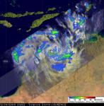
Top Left: NASA’s Tropical Rainfall Measuring Mission (TRMM) satellite captured this image of Laurence’s rainfall on Dec. 14 at 5:29 p.m. ET (2329 UTC). TRMM revealed a well defined center of circulation in Laurence with areas of heavy rain (red) up to 2 inches per hour. Credit: NASA/SSAI, Hal Pierce

Top Right: NASA Tropical Rainfall Measuring Mission (TRMM) satellite 3-D image shows thunderstorm tops reaching about 9.3 miles high in various sides of Cyclone Laurence (red). The red areas also indicate rainfall at about 2 inches per hour. Credit: Hal Pierce.


Severe Tropical Cyclone Laurence. AUSTRALIAN GOVERNMENT BUREAU OF METEOROLOGY/ TROPICAL CYCLONE WARNING CENTRE PERTH/ TROPICAL CYCLONE FORECAST TRACK MAP/  Issued at 2:41 pm WST Wednesday 16 December 2009. Image may be subject to copyright. Click on images to enlarge.

Remarks by BOM:

  • Severe Tropical Cyclone Laurence is a small but very intense tropical cyclone having VERY DESTRUCTIVE WINDS with gusts to 260 km/h .
  • Laurence is expected to weaken overnight IF it  moves  in a generally southerly direction towards Derby.
  • HEAVY RAIN is expected to continue over the north and west Kimberley. Daily rainfall totals in excess of 100mm are possible near the coast with totals decreasing further inland.

Related Links:

Posted in Derby, Laurence forecast track, Laurence projected path, Tropical Cyclone Laurence (06S) | Tagged: , , , | 1 Comment »

TC Laurence Intensifies to 140 km Winds

Posted by feww on December 15, 2009

Cyclone Update: TC Laurence Intensifies to 140 km/h Winds [Gusts of ] Despite Moving Close to Shore

TROPICAL CYCLONE 06S (Laurence)

Active Tropical Cyclone in Southern Hemisphere

  • Date Time: December 15 09:00 UTC
  • Approximate Position: 14.6ºS, 125.4ºE
  • Location:  Located approximately 530 nmi northeast of Port Hedland, Australia
  • Movement: Has been tracking southwestward at 06  knots during  the past six hours.
  • Max Sustained Winds:  075 knots, Gusts 090 knots [compared to winds of 35 kt and gusts of 45 kt 24 hrs ago]
  • Max Significant Wave Heights: 5.3 m (16 feet)

The system is now expected to move further inland and dissipate within the next 72 hours.


TC Laurence Revised Projected Path. Click image to enlarge. Source: JTWC


Infrared Mosaic Color Background  – Meteosat-7/MTSAT/GOES-West – South Pacific Region – CIMSS/SSEC/Wisc. Click image to update and enlarge.

Related Links:

Posted in Australia cyclone, cyclone, TC 06S, TC Laurence, tropical cyclone | Tagged: , , , , | 1 Comment »