Fire Earth

Earth is fighting to stay alive. Mass dieoffs, triggered by anthropogenic assault and fallout of planetary defense systems offsetting the impact, could begin anytime!

Posts Tagged ‘Supervolcanoes’

What triggers supervolcano formation?

Posted by feww on April 10, 2010

Serial No  1,555. Starting April 2010, each entry on this blog has a unique serial number. If any of the numbers are missing, it may mean that the corresponding entry has been blocked by the authorities/Google in your country. Please drop us a line if you detect any anomaly/missing number(s).

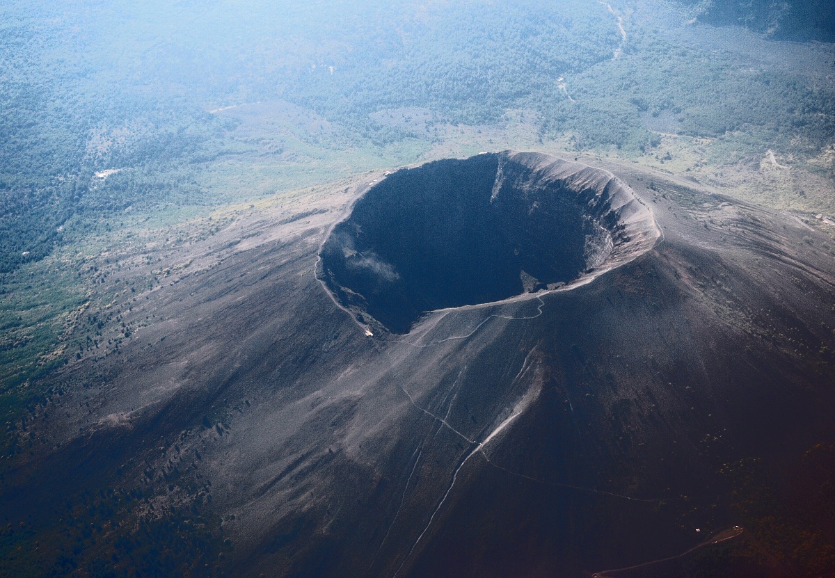
Largest supervolcanoes in the world

The following information bulletin released by the Texas A&M University is an introduction to a study of  what triggers formation of supervolcanoes by the IODP Shatsky Rise expedition.

Deciphering the mysteries of an ancient seafloor Goliath

The eruptions of “supervolcanoes” on Earth’s surface have been blamed for causing mass extinctions, belching large amounts of gases and particles into the atmosphere, and re-paving the ocean floor. The result? Loss of species, increased greenhouse gases in the atmosphere, and changes in ocean circulation. Despite their global impact, the origin and triggering mechanism of these eruptions remain poorly understood. New data collected during a recent Integrated Ocean Drilling Program (IODP) scientific research expedition in the Pacific Ocean may provide clues to unlocking this unsolved mystery in Earth’s geologic record.

In fall 2009, an international team of scientists participating in IODP Expedition 324 “Shatsky Rise Formation,” drilled five sites in the ocean floor to study the origin of the 145 million-year-old Shatsky Rise volcanic mountain chain. Located approximately 1500 kilometers (930 miles) east of Japan, Shatsky Rise measures roughly the size of California. This underwater mountain chain represents one of the largest supervolcanoes in the world: the top of Shatsky Rise lies three and a half kilometers (about two miles) below the sea surface, while its base plunges to nearly six kilometers (four miles) below the surface. Shatsky Rise is composed of layers of hardened lava, with individual lava flows that are up to 23 meters (75 feet) thick.

“Seafloor supervolcanoes are characterized by the eruption of enormous volumes of lava. Studying their formation is critical to understanding the processes of volcanism and the movement of material from the Earth’s interior to the surface,” remarked Dr. William Sager of Texas A&M University, who led the expedition together with co-chief scientist Dr. Takashi Sano of Japan’s National Museum of Nature and Science in Tokyo.

About a dozen supervolcanoes exist on Earth – some are found on land, while others lie at the bottom of the ocean. Those found on the seafloor are often referred to as “large oceanic plateaus.” Current scientific thinking suggests that these supervolcanoes were caused by eruptions occurring over a period of a few million years or less – a rapid pace in geologic time. Each of these supervolcanoes produced several million cubic kilometers of lava – about three hundred times the volume of all the Great Lakes combined – dwarfing the volume of lava produced by the biggest present-day volcanoes such as Hawaii.

Since the 1960s, geologists have debated the formation and origin of these large oceanic plateaus. The mystery lies in the origin of the magma, which is molten rock that forms within the Earth. A magma source rising from deep within the interior of the Earth has a different chemical composition than magma that forms just below the Earth’s crust. Some large oceanic plateaus exhibit signs of a deep-mantle origin. Others exhibit chemical signatures indicative of magma originating from a much shallower depth.

The IODP Shatsky Rise expedition focused on deciphering the relationship between supervolcano formation and the boundaries of tectonic plates, which may prove crucial to understanding what triggers supervolcano formation. A widely-accepted explanation for oceanic plateaus is that they form when a huge blob of magma source (a “plume head”) rises from deep in the Earth to the surface. An alternative theory suggests that large oceanic plateaus can originate at the intersection of three tectonic plates, known as a “triple junction,” but this mechanism is poorly understood. Shatsky Rise could play a key role in this debate, because it formed at a triple junction, but also displays certain characteristics that could be explained by the plume head model.

“Shatsky Rise is one of the best places in the world to study the origin of supervolcanoes,” Sager pointed out. “What makes Shatsky Rise unique is the fact that it is the only supervolcano to have formed during a time when Earth’s magnetic field reversed frequently.” This process creates “magnetic stripe” patterns in the seafloor. As Sager explained, “We can use these magnetic stripes to decipher the timing of the eruption and the spatial relationship of Shatsky Rise to the surrounding tectonic plates and triple junctions.”

According to preliminary results, sediments and microfossils collected during the expedition indicate that parts of the Shatsky Rise plateau were at one time at or above sea level, and formed an archipelago during the early Cretaceous period (about 145 million years ago). Shipboard lab studies further show that much of the lava erupted rapidly and that Shatsky Rise formed at or near the equator. As analyses continue in the months and years ahead, data collected during this expedition may help scientists to resolve the 50 year-old debate about the origin and nature of large oceanic plateaus.

IODP Expedition 324 “Shatsky Rise Formation” took place onboard the scientific ocean drilling vessel JOIDES Resolution from September 4 to November 4, 2009. The JOIDES Resolution is one of the primary research vessels of IODP, an international marine research program dedicated to advancing scientific understanding of the Earth through drilling, coring, and monitoring the subseafloor. The vessel is operated by the U.S. Implementing Organization of IODP, consisting of the Consortium for Ocean Leadership, Texas A&M University, and Lamont-Doherty Earth Observatory of Columbia University.

Contact: Kristin Ludwig
kludwig@oceanleadership.org
Texas A&M University

Posted in magma, oceanic plateaus, Shatsky Rise Formation, volcano | Tagged: , , , | 1 Comment »

VolcanoWatch Weekly [16 September 2009]

Posted by feww on September 17, 2009

VOW: Krakatoa [Krakatau]

Krakatoa is a volcanic island in the Sunda Strait located between Indonesian islands of Java and Sumatra. Both the volcano and island group share the same name.

Four enormous explosions almost entirely destroyed Krakatoa island on August 27, 1883. The violent explosions were reportedly heard in Perth, Western Australia,  some 3,500 km away. It was heard even on the island of Rodrigues near Mauritius, about 4,800 km away.

The shockwave from the last explosion, which ejected volcanic matter 80 km into the atmosphere, echoed around the planet seven times.

Karakatoa
An 1888 lithograph of the 1883 violent explosion of Krakatoa.

The eruption ejected about 21 cubic kilometers of volcanic matter and completely destroyed two-thirds of the Krakatoa island.

island map
The Island Map (Simkin and Fiske, 1983). Image may be subject to copyright.

Anak Krakatau (the Child of Krakatau)  is the only active vent left from Krakatoa. u is  This volcano has built itself slowly from the sea floor since the paroxysmal eruption of 1883.  Anak Krakatau is located between the northern two vents, Danan and Perboewatan, that were destroyed in the 1883 eruption.  For the most part, the eruptions are Vulcanian, slowly building the island with a combination of lava, ash, and pumice.

location map
Krakatoa: Location Map. Source of the original map: USGS

Krakatoa_01
Krakatoa: An early 19th Century image.

Early in the morning of May 20, 1883, the captain of the German warship Elizabeth reported seeing an ~11-km-high cloud of ash and dust rising above the uninhabited island of Krakatau, thus documenting the first eruption from this Indonesian island in at least two centuries. Over the ensuing two months, crews on commercial vessels and sightseers on charted ships would experience similar spectacles, all of which were associated with explosive noises and churning clouds of black to incandescent ash and pumice. From a distance, the largest of these natural fanfares impressed the local inhabitants on the coastal plains of Java and Sumatra, creating a near-festive environment. Little did they realize, however, that these awe-inspiring displays were only a prelude to one of the largest eruptions in historic times. A series of cataclysmic explosions began at mid-day on August 26, and ended on August 27 with a stupendous paroxysmal eruption. On this day, the northern two-thirds of the island collapsed beneath the sea, generating a series of devastating pyroclastic flows and immense tsunamis that ravaged adjacent coastlines. The events that began on August 26 would mark the last 24 hours on earth for over 36,000 people [possibly as many as 120,000,] and the destruction of hundreds of coastal villages and towns. —Geology-/SDSU [Spelling mistakes corrected by FEWW.]

ashcroft -riv thames
William Ashcroft painting “On the Banks of the River Thames” in London, November 26, 1883 [Exactly three months after Krakatoa’s cataclysmic 1883 eruption.]

The Krakatoa eruption affected the climate driving the weather patterns wild for the next 5 years. Average global temperatures fell by about 1.2 °C in the following years, returning to normal only in 1888.

landsat PP1
Krakatoa Image by Landsat Pathfinder Project (Dated May 18, 1992)

Anak Krakatau’s most recent eruptive episode began in 1994, with near continuous Strombolian eruptions, punctuated by larger explosions.  In its most recent eruption, which began in April 2008, the volcano released hot gases, rocks, and lava. Scientists monitoring the volcano have warned people to stay out of a 3 km zone around the island. By and large, the eruptions are Vulcanian, helping to slowly build the island with ash, lava and pumice at an average rate of about 60 cm per month.

Fearing an imminent eruption, Volcanological Survey of Indonesia raised Anak’s  eruption alert level to Orange on May 6, 2009.

SI /USGS Weekly Volcanic Activity Report
(9 September – 15 September 2009)

New activity/unrest:

News From GVP:

  • PHIVOLCS reported that 11 earthquakes from Mayon were detected during 14-15 September. On 15 September, three ash explosions produced a brownish plume that rose no more than 700 m above the crater and drifted SW.
  • On 11 September, KVERT reported strong explosions from Shiveluch. Based on interpretations of seismic data, ash plumes rose to an altitude greater than 15 km (49,200 ft) a.s.l. The seismic network then detected eight minutes of pyroclastic flows from the lava dome; resulting plumes rose to an altitude of approximately 10 km (32,800 ft) a.s.l. —GVP

Tafu-Maka


A bathymetric map prepared during a NOAA Vents Program November 2008 expedition shows two submarine volcanoes, Tafu (Tongan for “source of fire”) and Maka (Tongan for “rock”). The volcanoes lie along a NE-SW-trending ridge on the southern part of the back-arc NE Lau Spreading Center (NELSC). The November 2008 expedition discovered submarine hydrothermal plumes consistent with very recent (days to weeks?) submarine lava effusion from Maka volcano.  Image courtesy of NOAA Vents Program, 2008. Caption: GVP.

Ongoing Activity:


HAWAIIAN VOLCANO OBSERVATORY DAILY UPDATE

Wednesday, September 16, 2009 8:30 AM HST (Wednesday, September 16, 2009 18:30 UTC)

KILAUEA VOLCANO (CAVW #1302-01-)
19°25’16” N 155°17’13” W, Summit Elevation 4091 ft (1247 m)
Current Aviation Color Code: ORANGE
Current Volcano Alert Level: WATCH

Activity Summary for past 24 hours: The third DI event in a week started yesterday morning and switched to DI inflation overnight. Moderate glow was visible after dark from the Halema`uma`u Overlook vent (summit). Sulfur dioxide emission rates from the Halema`uma`u and east rift zone vents remain elevated. Lava from the TEB vent (east rift zone) flows through tubes to the ocean and feeds surface flows.

Past 24 hours at Kilauea summit:
Glow was visible from the Halema`uma`u Overlook vent overnight. This morning, trade winds are blowing the plume, denser than yesterday morning, to the southwest over the Ka`u Desert. The most recent sulfur dioxide emission rate measurement was 900 tonnes/day on September 11, which is well above the 2003-2007 average of 140 tonnes/day. Very small amounts of ash-sized rock dust waft up from the vent and are deposited nearby on the crater rim.

halema uma u
This Quicktime movie shows two active vents on the floor of the Halema`uma`u cavity. Lava is just below the rim of the two vents, creating frequent spattering which falls around their rims. Within the larger of the two (on the right), lava can be seen vigorously sloshing. For scale, these vents are about 10 yards wide. The first half of the movie is shown in normal mode, with the second half shown in ‘nightshot’ mode.

The summit tiltmeter network recorded the third DI event in a week with deflation just before 8 am yesterday and inflation just after midnight last night. The GPS network, which is less sensitive than the tiltmeter network, recorded less than 2 cm of contraction over the last 3 months with brief periods of extension coinciding with strong DI inflation on September 1-2 and 11-12; they recorded contraction since 9/13.

Seismic tremor levels remain elevated; two weak hybrid earthquakes followed by 15-20 minutes of sustained tremor were recorded starting around 7:30 pm last night. The number of RB2S2BL earthquakes continued to increase slightly but remained below background levels. Six earthquakes were recorded beneath Kilauea – three beneath the summit caldera, two deep quakes below the lower southwest rift zone, and one on south flank faults. —HVO

  • Videos and Images are available at: HVO

Related Links:

FEWW Volcanic Activity Forecast

Other Related Links:

Posted in Chaiten, FEWW Volcanic Activity Forecast, island of Java, Sumatra, volcanism, volcanoes | Tagged: , , , , , , , , , , , , | Leave a Comment »

VolcanoWatch Weekly [2 September 2009]

Posted by feww on September 5, 2009

Supervolcanoes may awaken

VOW: Mt Tambora

Mt tambora indonesia
Photo: Mark Webster/Lonely Planet Images. Image may be subject to copyright.

Tambora Photo
Country:    Indonesia
Region:    Lesser Sunda Islands (Indonesia)
Volcano Type:     Stratovolcano
Last Known Eruption:     1967 ± 20 years
Summit Elevation:     2,850 m     (9,350 feet)
Latitude:     8.25°S
Longitude:     118.00°E
Source: GVP


Tambora volcano on Indonesia’s Sumbawa Island was the site of the world’s largest historical eruption in April 1815. This NASA Landsat mosaic shows the 6-km-wide caldera truncating the 2850-m-high summit of the massive volcano. Pyroclastic flows during the 1815 eruption reached the sea on all sides of the 60-km-wide volcanic peninsula, and the ejection of large amounts of tephra caused world-wide temperature declines in 1815 and 1816. NASA Landsat7 image (worldwind.arc.nasa.gov). Caption GVP.

Mount Tambora (or Tomboro) is an active stratovolcano on Sumbawa island, Indonesia. Sumbawa is flanked both to the north and south by oceanic crust, and Tambora was formed by the active subduction zones beneath it. This raised Mount Tambora as high as 4,300 m (14,000 ft), making it one of the tallest peaks in the Indonesian archipelago.

Tambora erupted in 1815 with a rating of seven on the Volcanic Explosivity Index, making it the largest eruption since the Lake Taupo eruption in about 180 AD. It was the largest volcanic eruption in recorded history. The explosion was heard on Sumatra island (more than 2,000 km  away). Heavy volcanic ash falls were observed as far away as Borneo, Sulawesi, Java and Maluku islands. Most deaths from the eruption were from starvation and disease, as the eruptive fallout ruined agricultural productivity in the local region. The death toll was at least 71,000 people (perhaps the most deadly eruption in history), of whom 11,000–12,000 were killed directly by the eruption. The eruption created global climate anomalies; 1816 became known as the Year Without Summer because of the effect on North American and European weather. Agricultural crops failed and livestock died in much of the Northern Hemisphere, resulting in the worst famine of the 19th century. (Source: Wikipedia; edited by FEWW)

SI /USGS Weekly Volcanic Activity Report
(26 August-1 September 2009)

New activity/unrest:

  • Kanlaon, Negros Island (central Philippines)
  • Kolokol Group, Urup Island  (Kurile Islands,Sakhalin Oblast region, Russia)
  • Koryaksky, Eastern Kamchatka, Russia

Ongoing Activity:

Related Links:

FEWW Links:

FEWW Volcanic Activity Forecast

Posted in Chaiten, Kanlaon, Kolokol Group, Koryaksky, Kīlauea, Popocatépetl, Shiveluch | Tagged: , , , , , | 1 Comment »

Soputan volcano erupts

Posted by feww on June 8, 2008

Lava from Mount Soputan flows 2 km from crater

Indonesia’s Vulcanology Survey raised alert level for Soputan volcano located on Sulawesi island to level IV, the highest level, after it began ejecting hot lava and clouds of ash. Pyroclastic flows were extending about 2 km from Mount Soputan’s summit, but haven’t reached the foot of the mountain.

The authorities placed a 6-km exclusion zone around the volcano. Climbers are not allowed in the danger zone which also covers camping areas in the eastern part of the mountain about 4 km from the summit. According to a report, 6 volcanic earthquakes struck Mount Soputan on June 6.


People from a district in Minahasa look at columns of ash spewed from Mount Soputan, in Indonesia’s North Sulawesi province June 6, 2008. REUTERS/Stringer. Image may be subject to copyright. See FEWW Fair Use Notice!

“Stronger explosion may happen, which can emit dangerous materials from the crater,” Saut Simatupang, head of Indonesia’s Vulcanology Survey said.

The volcano has been erupting since Friday, spewing ash and debris to a height of about 2 km and covering an 8-km radius area around the crater.

“There is no need to displace the villagers. The frequency of the eruption has decreased since 2 a.m. Saturday,” he said.

Although no casualties have been reported, an eye witness in the village of Molompar in the Tombatu subdistrict in Southeast Minahasa, reported that a number of houses in Lobu, Silian, and Tombatu villages had collapsed as a result of volcanic ash deposits that had accumulated on the roofs.

Mount Soputan, a stratovolcano, is one of Indonesia’s 130 or so active volcanoes, which previously erupted 24–30 October 2007. In a 2004 eruption lava extended its southwest slope, but no fatalities were reported.

Related Links:

Related Video:

Posted in energy, environment, food, health, politics, Tourism, Travel | Tagged: , , , , , , , , , , , , , , , , , , , , , , , , , , , , , , , , , , , , , , , , , , , , , , , , , , , , , , | Leave a Comment »

Volcanoes, Santorini Eruption and Crops Failure in China

Posted by feww on May 14, 2008

*** Breaking News: May 19, 2008 Philippines Taal Volcano Could Erupt Anytime!

A New Era of Intense Volcanic Unrest May Have Begun

Where Could The Next Supervolcanic Eruption Occur?

1. Pico del Teide?
2. Mauna Loa?
3. Mount Vesuvius?

4. Mount Rainier?
5. Taal?
6. Thera?

Volcanoes

A volcano is an opening in a planet’s crust that allows ash, gases and molten rock to escape from below the surface.

Volcanoes are generally found where tectonic plates converge or divrge. A mid-oceanic ridge, for example the Mid-Atlantic Ridge, has examples of volcanoes caused by “divergent tectonic plates” pulling apart; the Pacific Ring of Fire has examples of volcanoes caused by “convergent tectonic plates” coming together.


Author:MesserWoland via Wikimedia Commons.This file is licensed under the Creative Commons Attribution ShareAlike license versions 2.5, 2.0, and 1.0

Cross-section through a stratovolcano:

1. Large magma chamber ◊ 2. Bedrock ◊ 3. Conduit (pipe) ◊ 4. Base ◊ 5. Sill ◊ 6. Branch pipe ◊ 7. Layers of ash emitted by the volcano ◊ 8. Flank ◊ 9. Layers of lava emitted by the volcano ◊ 10. Throat ◊ 11. Parasitic cone ◊ 12. Lava flow ◊ 13. Vent ◊ 14. Crater ◊ 15. Ash cloud

Eruption Types

There are many different kinds of volcanic activity and eruptions: phreatic eruptions (steam-generated eruptions), explosive eruption of high-silica lava (e.g., rhyolite), effusive eruption of low-silica lava (e.g., basalt), pyroclastic flows, lahars (debris flow) and carbon dioxide emission. All of these activities can pose a hazard to humans. Earthquakes, hot springs, fumaroles, mud pots and geysers often accompany volcanic activity. (Source)


Image by USGS

The concentrations of different volcanic gases can vary considerably from one volcano to the next. Water vapor is typically the most abundant volcanic gas, followed by carbon dioxide and sulfur dioxide. Other principal volcanic gases include hydrogen sulfide, hydrogen chloride, and hydrogen fluoride. A large number of minor and trace gases are also found in volcanic emissions, for example hydrogen, carbon monoxide, halocarbons, organic compounds, and volatile metal chlorides.

Large, explosive volcanic eruptions inject water vapor (H2O), carbon dioxide (CO2), sulfur dioxide (SO2), hydrogen chloride (HCl), hydrogen fluoride (HF) and ash (pulverized rock and pumice) into the stratosphere to heights of 16–32 kilometres (10–20 mi) above the Earth’s surface. (Source)

Decade Volcanoes

The Decade Volcanoes are 16 volcanoes identified by the International Association of Volcanology and Chemistry of the Earth’s Interior (IAVCEI) as being worthy of particular study in light of their history of large, destructive eruptions and proximity to populated areas. The Decade Volcanoes project encourages studies and public-awareness activities at these volcanoes, with the aim of achieving a better understanding of the volcanoes and the dangers they present, and thus being able to reduce the severity of natural disasters. They are named Decade Volcanoes because the project was initiated as part of the United Nations sponsored International Decade for Natural Disaster Reduction. (Source)

The 16 current Decade Volcanoes


Mount St. Helens shortly after the eruption of May 18, 1980


1 km steam plume ejected from Mount St. Helens photo taken by USGS on May 19, 1982 [Mount St. Helens is located in Skamania County, Washington, in the Pacific Northwest region of the United States.]

Mount St. Helens is most famous for its catastrophic eruption on May 18, 1980, which was the deadliest and most economically destructive volcanic event in the history of the United States. Fifty-seven people were killed; 250 homes, 47 bridges, 24 km of railways, and 300 km of highway were destroyed. The eruption caused a massive debris avalanche, reducing the elevation of the mountain’s summit from 2,950 to 2,550m and replacing it with a 1.5 km-wide horseshoe-shaped crater. The debris avalanche was up to 2.9 km³ in volume (VEI = 5). (Source)


A large eruption at Mount Etna, photographed from the International Space Station


Mount Etna, Sicily . Last Eruption 2007. [Photo Credit: Josep Renalias, via Wikimedia commons]
This file is licensed under the Creative Commons Attribution ShareAlike 2.5


Koryaksky Volcano seen in the background. Last Eruption: 1957. GNU Free Documentation License, Version 1.2 or any later version. See file detail.


Cleveland Volcano in the Aleutian Islands of Alaska photographed from the International Space Station.


Mount Nyiragongo volcano, Virunga Mountains, the Democratic Republic of the Congo. [The main crater is 250 m deep, 2 km wide and sometimes contains a lava lake. Nyiragongo and nearby Nyamuragira are together responsible for 40% of Africa’s historical volcanic eruptions. (Source: USGS) Last Eruption: 2008 (continuing)


The three summits of Mount Rainier: Liberty Cap, Columbia Crest, and Point Success [Last Eruption 1854]


The snow-capped summit of Pico del Teide in December 2004 – Active but dormant volcano, Tenerife, Canary Islands. Last eruption 1909. Photo: M. D. Hill. This work is licensed under the Creative Commons Attribution 2.5 License.


An aerial photo of Vesuvius. last Eruption 1944 [Author: Pastorius? Via Wikimedia Commons. ] This file is licensed under Creative Commons Attribution 2.5 License


Taal Volcano seen from across Taal Lake on the island of Luzon in the Philippines. Last Eruption: 1977.

Supervolcanoes: Nature’s “Thermonuclear” Arsenal


Satellite image of Thera, November 21, 2000. The Minoan caldera is at the lower part of the image and formed in the Minoan eruption 1630 and 1600 BCE. The whole caldera is formed of three overlapping calderas.

The Minoan eruption of Thera, also referred to as the Thera eruption or Santorini eruption, was a major catastrophic volcanic eruption (VEI = 6, DRE = 60 km3) which is estimated to have occurred in the mid second millennium BCE. The eruption was one of the largest volcanic events on Earth in recorded history. The eruption destroyed most of the island of Thera, including the Minoan settlement at Akrotiri as well as communities and agricultural areas on nearby islands and on the coast of Crete. The eruption contributed to the collapse of the Minoan culture.

The eruption caused significant climatic changes in the eastern Mediterranean region, Aegean Sea and much of the Northern Hemisphere. There is also evidence that the eruption caused failure of crops in China, inspired certain Greek myths, contributed to turmoil in Egypt, and influenced many of the biblical Exodus stories. It has been theorized that the Minoan eruption and the destruction of the city at Akrotiri provided the basis for or otherwise inspired Plato’s story of Atlantis. (Source)


Volcanic craters on Santorini. This file is licensed under Creative Commons Attribution 2.5 License [ photo: Rolfsteinar, via Wikimedia Commons]


Lake Taupo is a lake situated in the North Island of New Zealand. It has a perimeter of approximately 193km, a deepest point of 186 m and a surface area of 616 square km.

The lake lies in a caldera created following a huge volcanic eruption (see supervolcano) approximately 26,500 years ago. According to geological records, the volcano has erupted 28 times in the last 27,000 years. It has predominantly erupted rhyolitic lava although Mount Tauhara formed from dacitic lava.

The largest eruption, known as the Oruanui eruption, ejected an estimated 1,170 km³ of material and caused several hundred square kilometres of surrounding land to collapse and form the caldera. The caldera later filled with water, eventually overflowing to cause a huge outwash flood.


NASA satellite photo of Lake Taupo

Several later eruptions occurred over the millennia before the most recent major eruption, which occurred in 180 CE. Known as the Hatepe eruption, it is believed to have ejected 120 km³ of material, of which 30 km³ was ejected in the space of a few minutes. This was one of the most violent eruptions in the last 5,000 years (alongside the Tianchi eruption of Baekdu at around 1000 and the 1815 eruption of Tambora), with a Volcanic Explosivity Index rating of 7. The eruption column was twice as high as the eruption column from Mount St. Helens in 1980, and the ash turned the sky red over Rome and China. The eruption devastated much of the North Island and further expanded the lake. Unlike today, the area was uninhabited by humans at the time of the eruption, since New Zealand was not settled by the Māori until several centuries later. Taupo’s last known eruption occurred around 210 CE, with lava dome extrusion forming the Horomatangi Reefs. (Source)

Related Links:

Posted in energy, environment, food, Global Warming, health, Nature's Thermonuclear Arsenal, new zealand, VEI | Tagged: , , , , , , , , , , , , , , , , , , , , , , , , , , , , , , , , , , , , , , , , , , , , , | 10 Comments »