DISASTERS CAUSED BY CLIMATE CHANGE
EXTREME WEATHER EVENTS
PARALYZING WINTER STORM
STATE OF EMERGENCY
SCENARIOS 887, 785, 666, 560, [500,] 444, 187, 177, 157, 111, 078, 063, 027, 023, 02
.
NY Declares State of Emergency Amid Deadly Snowstorm
All 50 U.S. states experience freezing temperatures or colder weather as a polar vortex pushes arctic air across the country.
Every U.S. state, including Hawaii, saw temperatures plunge to freezing point or lower on Tuesday, said the National Weather Service (NWS).
State of Emergency Declared in New York
The arctic blast also prompted NY governor to declare a state of emergency in western and central New York due to heavy snow.
The counties included in the executive order are Cattaraugus, Chautauqua, Erie, Franklin, Genesee, Herkimer, Jefferson, Lewis, Oswego, Wyoming, and contiguous counties.
“This storm may persist until Friday morning with the potential for another two feet of snow,” said Cuomo, dispatching the National Guard. “New Yorkers in these areas should exercise extreme caution, and stay off the roads until conditions are clearer and safer.”
Up to 1.2 meters of snow is forecast for large swathes of western New York, while several areas could receive as much as 1.8 meters, said NWS.
Deadly Snowstorm
“Four people have died as a result of the snowstorm. Three of them succumbed, apparently from heart problems, two of them while shoveling the deep snow. Another was killed while attempting to push a car out of a drift,” said a report.
Surreal Storm
A New York highway superintendent called the snowstorm “surreal.”
“I’ve been here 33 years and this is one of the top ones,” he told The Buffalo News. “It’s surreal … this is one of the worst I’ve seen.”
Historic Event
“This will be a historic event. Absolutely. It is a historic event,” said a forecaster with NWS.
National High and Low Temperature (for the contiguous United States)
NWS Weather Prediction Center, College Park, MD
Issued 7 pm EST Tuesday, November 18, 2014
High Temperature for Tuesday, November 18, 2014
- 28°C (83 degrees F) at Homestead AFB, FL
Low Temperature for Tuesday, November 18, 2014
- -30°C (-22 degrees F) at Lamar Ranger Station, WY
Related Links
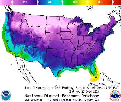
- First Paralyzing Winter Storm Arrives November 15, 2014
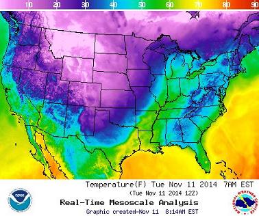
- 40 Degrees Below Average November 11, 2014
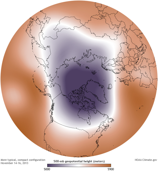
- Polar Vortex to Scythe through the U.S. Nov. 10, 2014