Fire Earth

Earth is fighting to stay alive. Mass dieoffs, triggered by anthropogenic assault and fallout of planetary defense systems offsetting the impact, could begin anytime!

Archive for March, 2011

Mother of All Sandstorms Scares the Daylight Away

Posted by feww on March 31, 2011

Tsunami of Sand Washes Over Arabia

Ginormous Sandstorm Sweeps Arabian Peninsula

A giant, fast-moving sandstorm, which started in Iraq and Kuwait on March 25, dropped visibility to near zero, shrouded Kuwait in instant darkness, shut down the city’s airport, disrupted traffic and terrified the people across the Arabian Peninsula.


Frame grab from a Youtube video clip.

Arabian Sand Storm


Click images to enlarge. Download larger image (6 MB, JPEG)


Download larger  image (5 MB, JPEG)

These two images of the storm  were taken by
MODIS on NASA’s Aqua satellite.  Top image was taken on March 26, and the bottom image 22-hours later on March 27.  Source: NASA-EO

Related Links

Posted in Dust Plague, dust storm, Dust Storms in Middle East | Tagged: , , , , | Leave a Comment »

Japan Nuclear Disaster Update – March 31

Posted by feww on March 31, 2011

UPDATED at 13:00UTC

Japan Should Consider Extending Radiation Evacuation Zone: IAEA

Radiation at Iitate village, 40 km (25 mile) NW of the crippled Fukushima NPP, exceeded safety limits

Radiation levels within the 40-km radius of Fukushima NPP has exceeded safety limits, the International Atomic Energy Agency (IAEA) said.

They have recorded 20 megabecquerels per square meter (20,000,000 Bq/m²) at the village, which is twice the agency’s evacuation criteria, NHK reported.

Two radioactive elements, iodine-131 and cesium-137, had caused the contamination, the report said.

[Note: One becquerel (Bq) represents one nucleus decay per second in a given quantity of radioactive material. 1 GBq = 0.0270 Curie (Ci). Curie is an older unit of radioactivity equal to the decay of 1 gram of radium-226.   1 Ci = 3.7 x 10^10 decays per second.]

“[IAEA has advised Japanese government to] carefully assess the situation on the basis of this report,” Japan’s Chief Cabinet Secretary Yukio Edano said at a daily news briefing earlier today.

“At the moment, we have no reason to think that the radiation will have an effect on people’s health. We need to closely monitor the situation and see if the radiation is consistently high,” Edano said.

“I don’t think that this is something of a nature which immediately requires such action.”

“But the fact that the level of radiation is high in the soil is inevitably pointing to the possibility that the accumulation over the long term may affect human health,” he added. “Therefore, we will continue monitoring the level of radiation with heightened vigilance and we intend to take action if necessary.”

Meanwhile,  radioactive iodine levels found in seawater about 330 meters south of the stricken plant’s water outlet has climbed by 4,385 times the legal limit, Japan’s nuclear and industrial safety agency (NISA) said. The latest reading is the highest level recorded since radiation first leaked from the plant following the Tohoku 9.0 Megaquake and tsunami, which struck the region on March 11.

The previous high for radioactive iodine found in seawater near Fukushima was reported yesterday at 3,355 times the legal limit.

Radiation at Iitate village

Dangerous radiation levels of about 10 microsieverts per hour have been recorded at Iitate village, according to Greenpeace, which has urging the Japanese government  to “stop choosing politics over science.”

“It is clearly not safe for people to remain in Iitate, especially children and pregnant women,” Greenpeace said.

Iodine 131 is believed to have caused the high incidence of thyroid cancer among children living near the Chernobyl plant when the 1986 nuclear disaster occurred.

Significant Aftershocks

Another significant aftershock measuring 6.2  struck the region about 114 km (71 miles) SE of  Morioka, and 126 km NE of Sendai, USGA/EQHP reported.

The quake was epicentered at 38.954°N, 142.017°E  and struck at a depth of about 39.6 km at 04:15:30 PM local time, EQ report said.


EQ Location Map. USGS/EHP

What is a lethal dose of radiation from a single Exposure?

Studies of the 1945 atomic bombing at Hiroshima and Nagasaki show that 100 percent of victims whose bodies were exposed to 600,000 millirems (6,000 mSv) died from radiation. About 50 percent of victims who received  450,000 millirems (4,500 mSv) of radiation also died.

(Note: Rem is a unit of ionizing radiation equal to the amount that produces the same damage to humans as one roentgen of high-voltage x-rays.  Source: MIT)

1 rem = 10 mSv  (1 Sv = 100 rem)

Background Radiation in millirems per year (mrem/yr)

  • Average background radiation (US):  300
  • Higher altitudes (eg. Denver): 400

“Safe Levels” of Radiation (U.S.)

Limits above natural background radiation levels (average 300 millirems per year) and medical radiation:

  • Occupation Limit: Maximum of 5,000  (the limit for a worker using radiation)
  • Average Natural Background: 300

[Note: Lifetime cumulative exposure should be limited to a person’s age multiplied by 1,000 millirems, e.g., a 70-year-old person, 70,000 millirems.]

Adults

  • Max single dose for an adult: 3,000
  • Annual total dose: 5,000

Under 18

  • Max single dose for a person aged under 18 years: 300 millirems (whole body equivalent)
  • Annual total exposure: 500

Fetal Exposure

  • Maximum limit for fetal exposure during gestation period:  50 millirems per month above background levels

Medical

  • Single Chest X-ray (the whole body equivalent): 2 millirem

Air Travel

  • Coast-to-coast US round trip flight: 12 millirems

Megaquake and Tsunami Death Toll

The latest figures released by the authorities put the number of dead at about  11,420, with 16,370 people still listed as missing.

Related Links

Posted in Fukushima Nuclear reactor, fukushima radiation leak | Tagged: , , , , , , , | Leave a Comment »

Arctic Ozone Loss Ahoy!

Posted by feww on March 30, 2011

Arctic losing ozone rapidly

Atmospheric ozone levels in the Arctic approaching the lowest levels on modern record

Large ozone depletion in the Arctic is currently occurring because of unusually low temperatures, according to extensive measurements carried out throughout the Arctic and Subarctic regions, which are coordinated by Germany’s Alfred Wegener Institute for Polar and Marine Research.


The above  ozone concentrations maps for the Arctic region are from  the OMI on NASA’s Aura satellite. Left image, showing relatively high ozone, is for March 19, 2010;  right, showing lower levels, is for the same date in 2011. See animation. Source: NASA-EO. Click image to enlarge.

“Our measurements show that at the relevant altitudes about half of the ozone that was present above the Arctic has been destroyed over the past weeks,” says AWI researcher Markus Rex.“Since the conditions leading to this unusually rapid ozone depletion continue to prevail, we expect further depletion to occur.”

“The changes observed at present may also have an impact outside the thinly populated Arctic. Air masses exposed to ozone loss above the Arctic tend to drift southwards later. Hence, due to reduced UV protection by the severely thinned ozone layer, episodes of high UV intensity may also occur in middle latitudes.” AWI said.

Related Links

Posted in ozone layer, UV radiation, UV-B | Tagged: , , , | Leave a Comment »

Fukushima Nuclear Disaster Update – March 30

Posted by feww on March 30, 2011

Radiation Rises in Seawater near Fukushima NPP

Radioactive iodine was detected at 3,355 times the legal limit in seawater some 330 meters south of Japan doomed Fukushima Daiichi nuclear plant, said Japan’s nuclear safety agency.

Iodine 131 is believed to have caused the high incidence of thyroid cancer among children living near the Chernobyl plant when the 1986 nuclear disaster occurred.

Highly radioactive water has inundated at least 3 reactor buildings and is also  found elsewhere at the stricken nuclear plant.

Half-life of some radioactive elements

[NOTE: Half-life is the time taken for a radioactive substance to decay by half.]

  • Cesium-134 ~ 2  years
  • Cesium-137 ~ 30 years
  • Iodine-131 ~ 8 days
  • Plutonium-239 ~ 24,200 years
  • Ruthenium-103 ~ 39 days [Ruthenium is a fission product of uranium-235.]
  • Ruthenium-106 ~ 374 days
  • Strontium-90 ~ 28.85 years  [Strontium-90 is a product of nuclear fission and is found in large amounts in spent nuclear fuel and in radioactive waste from nuclear reactors.]
  • Uranium-234 ~  246,000 years
  • Uranium-235 ~ 703.8  million years
  • Uranium-238  ~ 4.468 billion years

Source: Various

TEPCO UPDATE

The most ridiculous news out of Tokyo Electric Power Company (TEPCO): Chairman Tsunehisa Katsumata has told reporters that he thinks Fukushima Reactors 1 to 4 MAY HAVE TO BE SHUT DOWN PERMANENTLY!

[REALLY?]

Also, is he implying that Reactor 5 and 6, or any part of the Fukushima Dai-ichi for that matter, are still safe?

Death Toll

The number of people dead or missing from the megaquake and tsunami on March 11 stands at about 28,000 people.

Aftershock

Meanwhile another strong aftershock measuring 6.0Mw struck off the east coast of Honshu about 246 km (152 miles) ENE of Tokyo, USGS/EHP reported.

Japan Meteorological Agency (JMA) had not reported this quake, as of posting.

Related Links

Posted in japan earthquake, Japan earthquake forecast, japan earthquake map, Japan Earthquakes 2011 | Tagged: , , , , , | 2 Comments »

US Wildfire Pattern Consistent with Drought

Posted by feww on March 30, 2011

2011: The Worst Year for Wildfires?

Large parts of Alaskan (and Canadian) forests could be consumed by wildfires: FEWW forecast

US Drought Monitor


Click images to enlarge.


Temperature Forecast – 3 Months Outlook

Fire Information – National Fire News

Weather: Winds will weaken, but relative humidity will remain in the teens which will continue a heightened risk for large fire potential across New Mexico and west Texas today. Showers and thunderstorms will increase today in the southern United States. Scattered showers will continue from Washington and Oregon to Montana and Wyoming. Source

Click images to enlarge.


Source: NIFC

Related Links

Fire Information

Posted in wildfire, wildfires | Tagged: , , , , , , , | Leave a Comment »

M6.4 Shock Strikes Off Fukushima Coast

Posted by feww on March 29, 2011

Megaquakes could split Honshu island

Strong shock strikes about 126 km  ENE from Iwaki, Japan

FIRE-EARTH believes the recent strong shocks may be foreshocks to one or more “Earth Shattering” Megaquakes striking the region. Up to 4 Megaquakes [M ≥8.0] Could Strike Japan Region by 2015. The earthquakes could potentially split Honshu island.

See earlier earthquake forecasts posted at Japan Earthquakes: FIRE-EARTH Forecasts and Recent History.

The following quake details has just been released by Japan Meteorological Agency (JMA)

Earthquake Information (Information on seismic intensity at each site)
Issued at 19:59 JST 29 Mar 2011

Magnitude: 6.4
Depth:  very shallow
Location: 37.4ºN 142.4ºE
Occurred at 19:54 JST 29 Mar 2011
Region Name:   Fukushima-ken Oki (Offshore Fukushima Prefecture, Honshu, Japan)

Distances (USGS)

  • 126 km (78 miles) ENE (72°) from Iwaki, Honshu, Japan
  • 152 km (94 miles) SE (127°) from Sendai, Honshu, Japan
  • 161 km (100 miles) ESE (102°) from Fukushima, Honshu, Japan
  • 296 km (184 miles) NE (48°) from TOKYO, Japan

Earthquake Location Map

10-degree Map Centered at 35°N,140°E


Source: USGS

Related Links

Posted in japan earthquake map, Japan Earthquakes 2011, tohoku earthquake, Tohoku earthquake map, tokyo earthquake, tokyo earthquake forecast | Tagged: , , , | Leave a Comment »

How Nuclear Reactors Double as Nuclear Weapons!

Posted by feww on March 29, 2011

Japan Govt on “Maximum Alert”

The nuclear situation “continues to be unpredictable. [The government ] will tackle the problem while in a state of maximum alert,” Japan PM Naoto Kan said.

Plutonium Detected Outside Fukushima NPP

Traces of highly radiative plutonium have been detected in soil outside Fukushima NPP in half dozen locations, NHK quoted Japanese officials as saying.

The plant operator, Tokyo Electric Power Company (TEPCO), said  the radioactive traces may have come from the plutonium fuel in the damaged reactors. But they said the levels present were too small to pose a health risk.

Plutonium-239, the primary fissile isotope used as reactor fuel and for the production of nuclear weapons, is a reactor bred, highly radioactive heavy metal with a half-life of about 24,200 years.


Photo shows part of the wreckage caused by several explosions at Reactor No. 4, Fukushima Daiichi NPP, March 27, 2011. Source: Japan Ground Self-Defence Force/ via Kyodo/ via Reuters.

TEPCO said Monday that water found in a utility tunnel outside  Reactor 2 was highly contaminated, emitting more than 1,000 millisieverts per hour.

Radioactive Iodine in Massachusetts

Trace amounts of radioactive iodine-131 believed  to have originated from the quake-and-tsunami stricken Fukushima NPP have been detected in rainwater samples in Massachusetts, Reuters quoted state officials as saying.

The findings are consistent with similar occurrences in California, Ohio, Washington state and Pennsylvania, but do not pose  any threat to drinking supplies, according to public health officials.

“The drinking water supply in Massachusetts is unaffected by this short-term, slight elevation in radiation,” said Massachusetts Public Health Commissioner.

“We will carefully monitor the drinking water as we exercise an abundance of caution,” he added.

Radio-active iodine has a short life of only 8 days and should not pose any risk to human health at the current levels detected in the U.S.

Related Links

Posted in Nuclear Reactors, Nuclear Weapons | Tagged: , , , , , , , | 1 Comment »

Japan Nuclear Emergency – Update 28 March

Posted by feww on March 28, 2011

Fukushima Nuclear Disaster

Japan’s nuclear watchdog has reported that the level of radiation detected  near reactor 2 was 1,000 millisieverts an hour (100,000 millirems per hour).

Japan’s nuclear safety officials have since confirmed that the radiation inside Reactor 2 was caused by a partial meltdown of fuel rods.

TEPCO says the radiation in Reactor 2, which was earlier reported at 10 million times the normal, was actually 100,000 the operating level.

Meanwhile, Japan’s nuclear safety agency has dismissed as unreliable a report by Greenpeace that radiation levels of up to 10 microsieverts per hour had been detected 40 km (25 miles) NW of the nuclear plant.


Fukushima NPP. Workers are seen outside the heavily damaged Reactor 4 on March 22, 2011. Photo by TEPCO, via Reuters.

What is a lethal dose of radiation from a single Exposure?

Studies of the 1945 atomic bombing at Hiroshima and Nagasaki show that 100 percent of victims whose bodies were exposed to 600,000 millirems (6,000 mSv) died from radiation. About 50 percent of victims who received  450,000 millirems (4,500 mSv) of radiation also died.

(Note: Rem is a unit of ionizing radiation equal to the amount that produces the same damage to humans as one roentgen of high-voltage x-rays.  Source: MIT)

1 rem = 10 mSv  (1 Sv = 100 rem)

Background Radiation in millirems per year (mrem/yr)

  • Average background radiation (US):  300
  • Higher altitudes (eg. Denver): 400

“Safe Levels” of Radiation (U.S.)

Limits above natural background radiation levels (average 300 millirems per year) and medical radiation:

  • Occupation Limit: Maximum of 5,000  (the limit for a worker using radiation)
  • Average Natural Background: 300

[Note: Lifetime cumulative exposure should be limited to a person’s age multiplied by 1,000 millirems, e.g., a 70-year-old person, 70,000 millirems.]

Adults

  • Max single dose for an adult: 3,000
  • Annual total dose: 5,000

Under 18

  • Max single dose for a person aged under 18 years: 300 millirems (whole body equivalent)
  • Annual total exposure: 500

Fetal Exposure

  • Maximum limit for fetal exposure during gestation period:  50 millirems per month above background levels

Medical

  • Single Chest X-ray (the whole body equivalent): 2 millirem

Air Travel

  • Coast-to-coast US round trip flight: 12 millirems

Megaquake and Tsunami Death Toll

The latest figures released by the authorities put the number of dead at just over 11,000, with about 17,400 people still listed as missing.

Related Links

Posted in Japan Atomic Energy Agency, japan earthquake, Japan Earthquakes 2011, lethal radiation dose | Tagged: , , , , | 1 Comment »

M6.5 Aftershock Strikes Offshore Miyagi

Posted by feww on March 28, 2011

Strong aftershock strikes 109 km  E of Sendai, Japan

Tsunami Warning

Japan’s Meteorological Agency (JMA) initially warned that a 50-cm tsunami could hit Miyagi coast, but later removed the tsunami advisory.

Earthquake Details

Magnitude: 6.5
Occurred at (JST):  07:24 JST Mar 28, 2011
Location:  38.3ºN, 142.4ºE
Depth: very shallow
Region Name: Miyagi-ken Oki (Offshore Miyagi Prefecture)
Source: JMA

NO links between large quakes?

Two researchers from USGS and University of Texas who have analyzed  recent earthquakes greater than magnitude 7, say they have found “no link” between them.

[Presumably some of them are caused by the movement of moon, while the others are caused by Venus, or Mars!!]

The study is being published by the journal Nature Geoscience, a report said.

Related Links

Posted in environment, tohoku earthquake, Tohoku earthquake map | Tagged: , , , , | Leave a Comment »

Japan’s Nuclear Crisis: Worst of its Triple Disasters

Posted by feww on March 27, 2011

Submitted by a reader, with additional materials added by FIRE-EARTH

Fukushima Nuclear Disaster, the Third of Japan’s Triple Disasters, Could Prove to Be its Worst

Potentially deadly levels of radiation have been detected in water at the earthquake-and-tsunami-stricken Fukushima NPP.


Fukushima NPP 1. (L-R) Reactors 1 to 4. Image dated March 18, 2011. Credit: Digital Globe.

The amount of radioactive iodine detected in water at Reactor 2 was more than 1,000 millisieverts an hour, or 10 million times higher than when reactor operates normally, said the plant operator TEPCO.

The IAEA boss, Yukiya Amano, has warned that the nuclear crisis could continue for many weeks, even months. “This is a very serious accident by all standards,” NY Times quoted him as saying.

Radioactivity in seawater near the plant jumped to 1,850 times the normal up from 1,250 on Saturday, said Japan’s Nuclear and Industrial Safety Agency.

Fukushima Disaster: Will it Become Much Worse than Chernobyl?

The Chernobyl nuclear plant reactor was destroyed when two explosions blew away its roof exposing the core on April 26, 1986. A large plume of radioactive materials escaped into the atmosphere covering large regions in the former Soviet Union, Europe and across much of the Northern Hemisphere.


Ukrainian city of Chernobyl had managed to live for 793 years… that is until the Chernobyl nuclear power plant underwent a core meltdown on April 26, 1986 at about 1:00am local time. This image was taken by authorities in the former Soviet Union


Birth defects and cancer were the norm for many years following the Chernobyl disaster.  By the time  residents of Pripyat, a town located near the plant, were ordered to evacuate, about two days after the Chernobyl core meltdown had occurred, many had already been exposed to varying doses of radiation poisoning.

Fukushima NPP is said to contain about 4,277 tons of nuclear fuel, about 24 times as much as Chernobyl (~ 180 tons).

“The Fukushima Dai-ichi site has a considerable number of fuel rods on hand, according to information provided Thursday by Toyko Electric Power Co., which owns the atomic complex: There are 3,400 tons of fuel in seven spent fuel pools within the six-reactor plant, including one joint pool storing very old fuel from units 3 and 4. There are 877 tons in five of the reactor cores. Officials have said that the fuel in Unit 4’s reactor vessel was transferred to its spent fuel pool when the unit was temporarily shut in November.” AP reported.

The Incident: A meltdown of the reactor’s core in the Chernobyl power plant killed thirty people in 1986. About 135,000 people were evacuated. It is believed that about one hundred times more radiation was released in the accident than by the atom bombs dropped over Hiroshima and Nagasaki in 1945.

Legacy: More than 4000 cases of thyroid cancer were diagnosed among children and adolescents between 1992 to 2002 in Belarus, Russia and Ukraine. Victims under 14 years were most severely affected by the elevated concentrations of radioiodine found in milk.

Incidents of skin lesions, respiratory ailments, infertility and birth defects were readily found among the more than five million people who inhabit the affected areas of Belarus, Russia, and Ukraine for many years following the accident.

The Poisoned land. Up to 5 million people continue to live on radioactive contaminated land. About 85% of the children who live in contaminated areas of Belarus today are ill, a near 6-fold increase compared to the time before the explosion (15%), according to The Belarusian National Academy of Sciences.

Disputed Facts: The above facts, however, have been disputed by a number of individuals including the author of a recent WHO report, and the retired “nukophile” British academic, James Lovelack. Local and international experts, however, have dismissed the WHO report findings. A UN report released in 2005 estimated the number of victims at just 4,000. Their figure is hotly disputed  by NGOs and independent experts.

“A report by Alexey Yablokov, Vassily Nesterenko and Alexey Nesterenko which appeared in the Annals of the New York Academy of Science showed that by 2004, there were 985,000 additional deaths worldwide caused by the nuclear disaster, including 212,000 of them within Western Russia, Belarus and Ukraine.”

Chernobyl fallout covers the entire Northern Hemisphere

Consequences of the Catastrophe. Authors  Alexey Yablokov (Center for Russian Environmental Policy in Moscow), Vassily Nesterenko and Alexey Nesterenko ( Institute of Radiation Safety, Minsk, Belarus) studies about 5,000 reports and scientific  papers mostly published in Slavic languages and compiled their finding in the  book “Chernobyl: Consequences of the Catastrophe for People and the Environment,” which was published last year on the 24th anniversary of the Chernobyl reactor core meltdown.

“For the past 23 years, it has been clear that there is a danger greater than nuclear weapons concealed within nuclear power. Emissions from this one reactor exceeded a hundred-fold the radioactive contamination of the bombs dropped on Hiroshima and Nagasaki.” They wrote.

“No citizen of any country can be assured that he or she can be protected from radioactive contamination. One nuclear reactor can pollute half the globe,” the authors said. “Chernobyl fallout covers the entire Northern Hemisphere.”

According to the book, a total of about 830,000 people, referred to as the “liquidators,” were responsible for various emergency works at the Chernobyl site including fire extinguishing, decontamination and cleanup.

The authors say between 112,000 and 125,000 of the  liquidators had died by 2005.  The authors also estimate that between 1986 and 2004 some 985,000 people died as a result of Chernobyl fallout {2011 estimates are well over a million deaths.]

“Official discussions from the International Atomic Energy Agency and associated United Nations’ agencies (e.g. the Chernobyl Forum reports) have largely downplayed or ignored many of the findings reported in the Eastern European scientific literature and consequently have erred by not including these assessments.” The authors said last year.

Chernobyl and Other Nuclear Stats

  • More than 95% of the radioactive material (180 metric tons with a radioactivity of about 18 million curies) still remains inside the Chernobyl reactor.
  • The  core meltdown at Chernobyl was said to have released radiation estimated at 50 million curies. Committee on the Safety of Nuclear Installations said in 1995 that the meltdown had released about 140 million curies. [Researchers Alexey Yablokov, Vassily Nesterenko and Alexey Nesterenko say the radiation released from Chernobyl may have been up to 10 billion curies. In comparison, the Hiroshima bomb released about 3 million curies.]
  • Immediately after the accident, 237 people suffered from acute radiation sickness, and 31 died within the first 90 days of the disaster.
  • About 135,000 people were evacuated from the area surrounding the plant, including 50,000 from the town of Pripyat.
  • The Academy’s  estimate for the number of casualties  are more than 90,000 deaths and more than a quarter of a million cancer cases.
  • The Ukrainian National Commission for Radiation Protection calculates the number of radiation casualties at half a million  deaths so far.
  • In a book published by the New York Academy of Sciences last year on the 24th anniversary of the reactor core meltdown, the researchers maintain that about one million people have died from exposure to radiation released by the Chernobyl reactor so far [as of 2010.]
  • “In the former Soviet Union at least 9 million people have been effected by the accident; 2.5 million in Belarus; 3.5 million in Ukraine; and 3 million in Russia. In total over 160 000 Km2 are contaminated in the three republics.” source
  • Some 441 commercial nuclear power reactors are  operating in 31 countries ( total capacity of 376 gigawatts) each of which is potentially as lethal as Chernobyl, if not worse. [This item, updated here, was written before the Fukushima nuclear disaster began unfolding.]
  • An estimated 56 countries operate more than 250 research reactors.
  • At least 220 nuclear reactors power military ships and submarines.

Related Links:

References:

Posted in fukushima nuclear disaster, Japan Atomic Energy Agency, japan earthquake, Japan Nuclear alert | Tagged: , , , , | 1 Comment »

National Fire Stats Falsified?

Posted by feww on March 27, 2011

Hundred Wildfires Erupt in Georgia

Wildfires in Georgia – Satellite Image


About a dozens large fire (outlined in red) were burning in southeastern Georgia on March 25, 2011 when MODIS on NASA’s Aqua satellite captured the above image. “The U.S. Forest Service identified the fires as being the Sessom Community Fire and the Elm Church Road Fire. They were among at least 11 large fires burning in Georgia on March 25. The Elm Church Road fire burned 2,000 acres on March 24, threatening the town of Cogdell, said the Georgia Forestry Commission. The fire was clearly still large the next day, when this image was taken. Georgia’s governor declared a state of emergency in the counties where the two large fires were burning.” Source: NASA-EO.   Click image to enlarge. Download larger image (3 MB, JPEG).

Fire Activity Continues

Heavy fire activity continues throughout Georgia, said  Georgia Forestry Commission. Since March 23, fire fighters have responded
to as many as 100 wildfires that have burned thousands of acres.

National Fire Stats Falsified?

Meanwhile, the National Interagency Fire Center have substantially revised and reduced their Year-to-date statistics. On Thursday March 24, 2011 the figures were as follows:

Year-to-date statistics 2011 (1/1/11 – 3/24/11)

  • Fires: 15,906
  • Acres: 616,427

Just a day later, the burnt-out acreage had shrunk by about 14 percent,  while the number of fires had actually climbed.

  • Fires: 16,208
  • Acres: 530,611

No explanation was provided as to the reason for the drastic alteration in burnt-out acreage extent.

See below for a partial Print Screen:


Click image to enlarge.

Meanwhile, Georgia gov. has declared a state of emergency because of the wildfires.

Fire status on Saturday from the GFC:

  • Bacon County — fire burning SW Bacon County and N. Ware County, 13,600 acres consumed, 40 percent contained.
  • Clinch County — fire burning in Arabia Bay, 16,000 acres burned, including portions of the community Berry Patch and the city of Homerville. Many residential and commercial structures are threatened, evacuations are underway.
  • Camden County – Mary Fields Plantation fire SW of Kingsland has destroyed 2,500 acres,  20 percent contained; Catfish Landing fire contained at 125 acres, caused when fire previously ruled arson reignited.
  • Coffee County — Moseley Road fire has consumed 1,595 acres; MC Jowers fire is contained at 200 acres.
  • Appling County – fire burning S. of Surrency is contained.
  • Brantley County — Fire off Highway 110 East contained at 5.9 acres (ruled as arson).
  • Jeff Davis County — contained at 75-80 acres.
  • Long County — Ludowici fire burned 4,000 acres, three homes destroyed; 75 percent contained. Doctor’s Creek area now in focus.
  • McIntosh County — Two fires burning north of Darien, homes under evacuation.
  • Wayne County — fire burning near Screven, now contained at 125 acres.

Related Links

Fire Information

Posted in Cogdell fire, national fire stats, wildfire | Tagged: , , , , , , | Leave a Comment »

Radiation Contaminates Sea Near Fukushima NPP

Posted by feww on March 26, 2011

Radioactive iodine in the sea near Fukushima NPP 1,250 times higher than the safety limit: Officials

Today’s news is about radioactive leaks in Fukushima, Japan, tomorrow you could hear about similar or worse incidents at a plant near you.

The following article was first published in May 2004 and is one of the most read pieces on the proliferation of nuclear energy. It’s reprinted here with the kind permission of MSRB Blog.

On The Way To Armageddon: Could We Make A Detour?

James Lovelock: ‘Only nuclear power can now halt global warming’

Lovelock’s assertion that “Only nuclear power can now halt global warming” [Independent UK, May 24, 2004] is what Ed Regis (Great Mambo Chicken and the Transhuman Condition) calls turn of century’s “great wave of fin-de-siècle hubristic mania.” The Professor can be forgiven for his tardiness: He is 84.

Lovelock proposes that a massive expansion of nuclear power is the only thing that “can now check a runaway warming which would raise sea levels disastrously around the world, cause climatic turbulence …”

He says he is concerned by “two climatic events in particular: the melting of the Greenland ice sheet, which will raise global sea levels significantly, and the episode of extreme heat in western central Europe last August, accepted by many scientists as unprecedented and a direct result of global warming.” He is right to be concerned.

As well, “climate change is speeding, but many people are still in ignorance of this.” Unfortunately, he is right on target on this one, too.

Tony Juniper, director of Friends of the Earth, says: “Climate change and radioactive waste both pose deadly long-term threats, and we have a moral duty to minimize the effects of both, not to choose between them.”

“[A]s of the end of 2000 the world counted 438 reactors with a total of 350 GW, less than 8 percent of the projected nuclear capacity. They produced about 17 percent of the world’s electricity or about 7.5 percent of its commercial primary energy, far behind oil (40%), coal and natural gas (25% each). Nuclear power accounts for only 2 to 3 percent of the world’s commercial final energy consumption.” http://www.greens-efa.org

Lovelock also fails to consider the issue of time frame: It would probably take 15 to 20 years to even double the projected nuclear capacity from 8 to 16 percent (increasing to 5 percent the nuclear share of world’s commercial final energy consumption) without taking too many shortcuts with devastating consequences (the Chernobyl disaster, the Three Mile Island incident, and many recent near misses in Japan and elsewhere spring to mind). By then, however, the rising sea levels will have inundated most of the existing reactors.

How would Lovelock propose to solve the civilization’s mobility dilemma that we have created in the last 100 years? (About 600 million cars are registered worldwide, as well as millions of trucks and buses, thousands of trains, planes, boats … and millions more are being manufactured each year). What is Lovelock proposing, cars running on nuclear powered batteries? [How about nuclear-powered jets flying over Washington DC?]

Soon the additional demand for oil fueled by the increase in the number of vehicles on the roads and planes in the air would render the nuclear conversion ineffective. The only thing to show for a fleeting moment of madness would be a bigger pile of radioactive waste, which no one knows what to do with.

Global Warming is not the disease; it’s a symptom, albeit the most serious symptom of a cancer caused by industrial civilization. Prescribing more nuclear power (even if it were physically possible) as a cure to the civilization’s cancer is tantamount to treating a smoker’s lung-cancer by switching her over to a different brand of cigarettes.

According to Lester Brown (Earth Policy Institute) the world experienced the fourth consecutive harvest shortfalls in 2003. Last year’s shortfall of 105 million tons (5.4 percent of the total world consumption) was “easily the largest on record.” The world’s carryover stocks of grain are at their “lowest level in 30 years,” amounting to “dangerously low level of 59 days of consumption.” The minimum level needed for food security is considered to be 70 days of consumption. Meanwhile, 74 million people will be added to the world population in 2004. (www.earth-policy.org/Updates/Update40_data.htm).

Based on the United Nations projections, by 2015 nearly 1.4 billion people in up to 48 countries will face severe water shortages (we believe this figure is highly optimistic), while the water quality continues to deteriorate globally from pollution and rising temperatures.

World oil production is about 80 million BPD [barrels per day] and the projected demand for 2015 [a conservative estimate] is an unsustainable 135 million BPD. The New Oil-Rule Economy will replace the “old” economy in the very near future. A single company/organization will have a monopoly on about 80 percent of “economically recoverable” global oil reserves. It will dictate “production,” pricing, and delivery (and will even decide on the end user – who may or may not buy the oil). How much is too much for a barrel of oil, $40, $240, or $4,000 a barrel? Soon, the current monetary system will be of no value.

mushroom-cloud-hb.jpg

The world spent about 1,500 billion dollars on military [the war racket] in the last 12 months. The US share of the spending was about 1,000 billion dollars, or 52 cents in every dollar of Federal Funds (current military spending 29 percent; Iraq and Afghanistan 4 percent; past military 19 percent, including national debt created by military spending) while 35 million Americans live at or below the federal poverty level.

All around us we have created a garbage quicksand. We are sinking rapidly in a quicksand of 57 trillion pounds of materials that is turned into waste annually. Of course, there is a price to pay: The Sixth Great Extinction is looming.

To avert extinction we need an ecological revolution. We must unlearn, rethink, undo, and re-do all human activities re-mapping a sustainable path within the framework of eco-centrism.

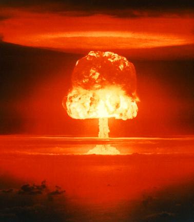
Unless the dynamics of our civilization pertaining to our morality, militarism, mobility, consumption, and our perceived ideas about possession and waste are reversed rapidly, this writer believes, the “final” war (which is being fought over the control of resources) would, in the very near future, enter its next sinister stage – a global thermonuclear holocaust.

How else could you prevent anyone in China, to quote but one example, from eating a square meal a day, or owning a car, or the gasoline to drive her car, while the United States with less 5 percent of the world population is taking more than 25 percent of the energy and 30 plus percent of all the resources?

We must begin a new chapter in human evolution, one that rejects wars for control over the oil, food, water supplies, and other resources.

But how do we do it? Is there a “single” solution that would avert an all-out nuclear war, prevent further militarism, check global warming, stop consumerist madness, reduce CO2 emissions by more than 80 percent, reduce acid rains, minimize toxins in the land, air, and sea … ?

The Zero Oil Solution

Yes there is. The zero-oil, NO fossil fuel principle—a moratorium on oil extraction and fossil fuel consumption.

Freeze the oil. Seal the oil wells. Cement them, or otherwise make it impossible to pump out any oil for 50 years. Keep all the fossil fuels in the ground, where they belong!

Stopping the flow of oil globally and keeping the fossil fuels in the ground are drastic measures, of course, and cannot be easily implemented. Freezing the consumption of fossil fuels has far-reaching socio-economical implications; it will create great upheavals. The consequences of the zero-oil, NO fossil fuel principle, however, would be far less devastating than the remaining alternatives: The inevitable global thermonuclear war, and global warming.

A moratorium on oil and fossil fuel production can only be reached through global consensus among governments; it would require an unprecedented level of cooperation among the “representatives” of nations.

The existing resources need to be redistributed fairly; populations must be readied to assume new challenges; lifestyles will be changed dramatically; communities would have to learn how to produce their food (and renewable power) locally, be sustainable and learn to do more with less.

Unfortunately, this author does not believe such levels of cooperation could possibly develop between the world governments anytime soon.

We must, therefore, rely on “we the people.” We need non-violent volunteer organizations to develop and promulgate a new, unified value system based on an eco-centric economy at war speed, employing creative ways and means of stopping the flow of oil and consumption of fossil fuels globally to avert The Sixth Great Extinction.

If we choose life, that’s a price well worth paying for.

Related Links:

Posted in Japan Earthquakes 2011, Japan Nuclear alert, Japan Primary Energy, Japan quake, mick, tohoku earthquake | Tagged: , , , , , | Leave a Comment »

Myanmar Quake Update

Posted by feww on March 26, 2011

First entry:

Magnitude 6.8 Quake Strikes MYANMAR

UPDATE

Death toll from the quake has reached at least 75 with up to  150 people injured, according to various reports.

“The quake also destroyed 390 residential houses, 14 monasteries and 9 government department buildings in the mainly affected areas of Tachileik, Tarlay, Naryaung and Monglin.” Xinhuanet said.


Original caption: “The video image taken from the telecast of Myanmar Radio and Television (MRTV) on March 25, 2011 shows a big crack on a road damaged in an earthquake in Myanmar’s northeastern region.” Via xinhuanet.

Quake Summary

Magnitude: 6.8
Date-Time: Thursday, March 24, 2011 at 13:55:12 UTC
Location: 20.705°N, 99.949°E
Depth: 10 km (6.2 miles)
Aftershocks: 3 reported, including 2 significant shocks measuring 5.4 and 5.0Mw


EQ Location Map. Source: USGS. Enhanced by FIRE-EARTH

Posted in 2011 disaster forecast, 2011 disasters, 2011 earthquakes, deadly earthquakes, earthquake update, Earthquakes | Tagged: , , | Leave a Comment »

M6.2 aftershock strikes off the coast of Myagi

Posted by feww on March 25, 2011

Strong Shock Strikes 107 km (66 miles) ENE of Sendai, Honshu, Japan

EQ Details
Region: Near East Coast of Honshu, Japan
Time: 2011-03-25 11:36:25.4 UTC
Magnitude: 6.2 Mw
Epicenter: 141.99°E 38.74°N
Depth: 46 km
Status: M – manually revised
Source: GFZ Potsdam – Earthquake Bulletin

Related Links

Posted in japan earthquake, Japan Earthquakes 2011 | Tagged: , | Leave a Comment »

10,000 times the normal radiation at Fukushima R3

Posted by feww on March 25, 2011

Fukushima Nuclear Disaster Continues to Unfold

Dangerously high radiation levels detected in water at Reactor 3: TEPCO

Tokyo Electric Power Company (TEPCO) says it has detected dangerously high radiation levels of radiation at Fukushima NPP Reactor 3, which could mean the core has been damaged.

Japanese government says it’s doing all it can to establish the cause of radiation leak at the stricken nuclear complex, and have asked residents living within 20-30km (12-18 miles) of the nuclear plant to leave voluntarily. Until today, residents had been asked to stay indoors.

Two workers at the nuclear facility who were exposed to dangerous levels of radiation remain in hospital. Apparently they had not been wearing protective boots and had ignored a radiation alarm, according to Kyodo news agency.

“As of 24 March, 19:30 Japan time, the number of workers at the Fukushima Daiichi nuclear power plant found to have received more than 100 millisieverts of radiation dose totalled 17 including the three contract workers. The remaining fourteen are TEPCO’s employees.” IAEA said.

Meanwhile, two Japanese tourists from Tokyo who arrived in China were taken to a hospital after being found contaminated with high radiation levels, Xinhuanet said.

Mystery surrounds the case as to how the two men became contaminated as neither of them had been within 240km radius of the Fukushima NPP, BBC said.

This news came amid an earlier report that  higher than normal radiation had been detected on a Japanese merchant ship entering the Xiamen port in Fujian province, Xinhua news reported.

Japanese Government has confirmed that levels of radioactive iodine detected in Tokyo’s tap water earlier this week  have since dropped to about normal levels, however radiation levels are still high in various areas of northern Japan.

Decommissioning of older nuclear plants big problem: IAEA

Many of the 441 nuclear reactors operating worldwide were built in the 1970s and 1980s, with an average lifespan of about 35 years (including those at Fukushima plant).

“Their decommissioning peak will occur from 2020 to 2030 which will present a major managerial, technological, safety and environmental challenge to those states engaged in nuclear decommissioning,”  according to a draft safety report by IAEA.

Is it Safe?


Construction of 4 pressurized water reactors at Cattenom Nuclear power plant in France began in 1979. CC-License.

Countries with 10 or more nuclear reactors:

The United States: 104  (Highest number of operational units)
France: 58
Japan: 54
Russia: 32
S. Korea: 21
India: 20
UK: 19
Canada: 18
Germany: 17
Ukraine: 15
China: 13
Sweden: 10

The Basic Points that are Overlooked by the International Atomic Energy Clan

1. Earth is a seismic planet and earthquakes regularly strike various regions.

2. The Pacific Ring of fire is particularly prone to earthquakes, some of them large earthquakes [Megaquakes.]

3. Larger quakes  can and do rip through ALL structures.

4. Offshore megaquakes are invariably followed by large tsunamis.

5. Large tsunamis invariable inundate vast areas, starting with coastal areas.

6. Nuclear power plants use electrical devices to operate vital cooling systems.

7. When inundated, electrical systems invariably fail.

All of the above, of course, is academic.

Related Links

Posted in Cattenom Nuclear power plant, international atomic energy mafia, japan earthquake, Japan Earthquakes 2011, TEPCO | Tagged: , , , , | Leave a Comment »

Denver wildfire forces evacuation of 10,000 homes

Posted by feww on March 25, 2011

New fire rapidly scorches large area SE of Denver, Colorado

The latest fire, which erupted as firefighters struggled to contain a separate blaze (Indian Gulch in Jefferson County),  has scorched about [2,000] acres on the wooded cliffs  near Franktown, Colorado, according to Douglas County Sheriff’s Office.

“We’re not aware of any structures lost, but the high winds are pushing it close to heavily populated neighborhoods, so we called for mandatory evacuations.”

Fire at Miami International Airport

“A spectacular fire that led to cancellations of 179 flights and delayed dozens more at Miami International Airport may have been caused by an electrical failure in a complex grid of underground pipes that pumps fuel to hundreds of planes each day.” Said a report.

Large fires are currently reported in the following states:

  • Arizona (1)
  • Arkansas (1)
  • Colorado (1)
  • Georgia (1)
  • Kansas (1)
  • Missouri (3)
  • Oklahoma (7)
  • Texas (1)

Year-to-date statistics 2011 (1/1/11 – 3/24/11)

  • Fires: 15,906
  • Acres: 616,427

9-year average [2002  to 2010]

  • Acres: 396,282
  • Record: 1,792,721 (2006)

Red Flag Warnings

URGENT – FIRE WEATHER MESSAGE

National Weather Service (NWS) has issued Fire Weather Red Flag Warnings for

  • SE Colorado
  • Northern Central and Southern New Mexico
  • Western Texas
  • Wakulla and Leon Counties, Fl


Click image to enter NWS Portal.

NATIONAL WEATHER SERVICE EL PASO TX/SANTA TERESA NM —  9:57 PM MDT THU MAR 24 2011

…A RED FLAG WARNING IS IN EFFECT FOR FRIDAY AFTERNOON AND EARLY FRIDAY EVENING FOR ALL OF SOUTHWEST AND SOUTH CENTRAL NEW MEXICO AND FAR WEST TEXAS DUE TO WINDS GREATER THAN 20 MPH… RELATIVE HUMIDITY BELOW 15 PERCENT AND VERY HIGH OR EXTREME FIRE DANGER RATINGS…

…A FIRE WEATHER WATCH IS IN EFFECT FOR SATURDAY AFTERNOON FOR THE SOUTHWEST…SOUTH-CENTRAL NEW MEXICO LOWLANDS AND FAR WEST TEXAS FOR WINDS GREATER THAN 20 MPH…RELATIVE HUMIDITIES 15 PERCENT OR LOWER AND VERY HIGH FIRE DANGER RATINGS…

All Warnings List available at NWS website.


Today and tonight: A Pacific storm system and associated cold front will move across  the area this evening. Snow will develop across the mountains by
this evening, continuing overnight. Snow accumulations of up to 2 inches can be expected over the higher mountains by Friday morning.  Gusty south to southwest winds will continue to develop across the foothills and plains this afternoon, shifting to the west this evening with gusts to 40 mph possible behind the front. From Boulder to Denver to Limon and areas south, relative humidities are expected to fall below 15%. The combination of low humidities and
strong winds will produce a high fire danger. Strong winds will continue tonight along and near the foothills with gusts to 60 mph possible. [Source: NWS]

Related Links

Fire Information

Posted in wildfire, wildfires | Tagged: , , , , , | 1 Comment »

Magnitude 6.8 Quake Strikes MYANMAR

Posted by feww on March 24, 2011

Quake May Have Caused Heavy Damage

The epicenter was located in a mountainous region of Myanmar near the borders with Thailand and Laos.

Tremors were felt in Bangkok and Hanoi.

Buildings swayed in Bangkok, about 770 kilometers south of the epicenter, AP reported.

No reports of damage as of posting; however, heavy damage could have occurred near the epicenter because buildings in the rural region are believed to be vulnerable to strong shocks.

A5.8 quake, which struck Yingjiang County in southwest China’s Yunnan Province (MYANMAR-CHINA BORDER REGION), killed at least 24 people and injured more than 200 others two weeks ago, a report said. The shock also destroyed about 1,000 buildings.

Earthquake Details

Magnitude: 6.8
Date-Time: Thursday, March 24, 2011 at 13:55:12 UTC

Location: 20.705°N, 99.949°E
Depth: 10 km (6.2 miles)
Region: MYANMAR
Distances:

  • 89 km (55 miles) N of Chiang Rai, Thailand
  • 168 km (104 miles) SSW of Yunjinghong, Yunnan, China
  • 589 km (365 miles) NE of Rangoon, Myanmar
  • 772 km (479 miles) N of BANGKOK, Thailand

Location Uncertainty: horizontal +/- 15.4 km (9.6 miles); depth +/- 5.8 km (3.6 miles)
Source:  USGS NEIC (WDCS-D)

Event ID: usc0002aes

Related Links

Posted in 2011 disasters, 2011 earthquakes, earhquakes | Tagged: , , , | 2 Comments »

Wildfires Wreaking Havoc Across the U.S.

Posted by feww on March 24, 2011

12 Large Fires Burning Across the Country

Active fires have consumed more than 155,000 acres, with 6 new fires reported.

States currently reporting large fires:

  • Arizona (1)
  • Arkansas (2)
  • Colorado (1)
  • Hawaii (1)
  • Kansas (1)
  • Missouri (1)
  • Oklahoma (3)
  • Texas (2)

“The Rocky Mountain, Southern and Southwest areas are at a preparedness level 2, meaning that these areas have high fire danger and multiple large fires.” Said National Interagency Fire Center.

Oklahoma

Wildfires forced Oklahomans from their homes in two northeastern towns on Wednesday evening as fire threatened dozens of homes near the town of Prue, Osage County, and  scores of homes in the Oak Park area of Bartlesville, Washington County, officials said.

Big Island Hawaii

A large wildfire set off by the eruption of the Kilauea volcano on Hawaii’s Big Island earlier this month has consumed about 2,000 acres of national park land. The fire is burning on the volcano’s east rift in the Hawaii Volcanoes National Park about 12km SE of the Kilauea Visitor Center.


The spreading wildfire was started by lava splatters at the volcano’s Kamoamoa fissure, which erupted on March 5, and is currently being fanned by strong trade winds, said a spokesman for the National Park Service. Photo Credit: Suzanne Snow.

Current Wildfires
Arizona Fires: 1 Acres: 4,000 * New fires: 0 Fires contained: 0
Duke (Coronado National Forest): 4,000 acres at 15 percent contained. This fire is 11 miles northeast of Nogales. Structures are threatened and roads are closed.
Arkansas Fires: 2 Acres: 832 * New fires: 0 Fires contained: 3
Queen Simmons (Arkansas Forestry Commission): 632 acres at 90 percent contained. This fire is ten miles northwest of Clinton.
Long (Arkansas Forestry Commission): 200 acres at 98 percent contained. This fire is six miles south of Canaan.
Colorado Fires: 1 Acres: 1,162 * New fires: 0 Fires contained: 0
Indian Gulch (Jefferson County): 1,162 acres at 25 percent contained. This fire is one mile west of Golden. Muir’s IMT 1 is assigned to the incident. Residences are threanted and evacuations are in place.
Information: Visit the Rocky Mountain Coordination Center.
Hawaii Fires: 1 Acres: 2,010 * New fires: 0 Fires contained: 0
Napau (Hawaii Volcanoes National Park): 2,010 acres. This fire is nine miles west of Kalapana.
Kansas Fires: 1 Acres: 144,000 * New fires: 1 Fires contained: 0
* Stanton County (Kansas Counties): 144,000 acres at 70 percent contained. This fire is 30 miles south of Johnson City.
Kentucky Fires: 0 Acres: 0 * New fires: 1 Fires contained: 1
Missouri Fires: 1 Acres: 100 * New fires: 0 Fires contained: 0
Crane Cemetary (Mark Twain National Forest): 100 acres at 40 percent contained. This fire is six miles north of Houston.
Oklahoma Fires: 3 Acres: 1,770 * New fires: 1 Fires contained: 2
Bread Town (Oklahoma Department of Forestry): 880 acres at 75 percent contained. This fire is three miles northeast of Stringtown.
Rocky (Oklahoma Department of Forestry): 530 acres at 70 percent contained. This fire is four miles northeast of Marble City.
Trall Hollow (Oklahoma Department of Forestry): 360 acres at 85 percent contained. This fire is one mile southeast of Bell.
Texas Fires: 2 Acres: 1,400 * New fires: 3 Fires contained: 1
* Ralph Keller Ranch (Texas Forest Service): 1,000 acres at zero percent contained. This fire started on private land 14 miles northeast of Marathon. Residences are threatened.
* Koch (Texas Forest Service): 400 acres at zero percent contained. This fire started on private land nine miles south of Andrew

Source: National Interagency Fire Center

Year-to-date statistics
Period: 2011 (1/1/11 – 3/23/11)
Acres: 588,237

9-year Average
Acres: 396,282

Related Links

Posted in wildfire | Tagged: , , , , , , , | Leave a Comment »

Activity at Kilauea – Satellite Images

Posted by feww on March 24, 2011

Kilauea: The World’s Most Active Volcano

KILAUEA VOLCANO
Location: 19°25’16″N 155°17’13″W
Summit Elevation: 1,247 m
Current Volcano Alert Level: WATCH
Current Aviation Color Code: ORANGE
Source: HVO

HAWAIIAN VOLCANO OBSERVATORY DAILY UPDATE
Wednesday, March 23, 2011 7:34 AM HST (Wednesday, March 23, 2011 17:34 UTC)

Activity Summary for past 24 hours

  • No molten lava visible at Kilauea volcano surface
  • DI deflation continues
  • Lava lake crusted over very deep within the summit vent
  • Summit seismicity slightly elevated
  • SO2 emissions and ERZ seismicity are low at summit and East Rift ZoneS
  • Sulfur dioxide emission rate about 200 tons per day ((preliminary reading on March 22, 2011)

[NOTE: DI stands for ‘deflation-inflation’ and denotes a volcanic event of uncertain significance.]


Click images to enlarge. Download larger image (571 KB, JPEG)  — captured March 18, 2011


Download larger image (436 KB, JPEG)  —  captured January 16, 2010

“In the image—which depicts mostly infrared wavelengths of light—vegetation is green, older lava flows are brown to black, and “hot” areas are red. In this case, the scorched land and fresh lava in the burn scar appears slightly red and brown, while the still-burning forest fire appears bright red. In the 2010 image, lava stands out within and near Pu’u ‘O’o.” Source: NASA-EO.

On March 5, 2011, a new fissure appeared on Kilauea, the world’s most active volcano. Fresh lava from Kamoamoa fissure spewed to a height of about 50 meters above ground, setting off a forest fire which has since consumed about 2,000 acres.

Kamoamoa fissure is located about 13km  east of the volcano summit, lying along the rift zone between Pu’u ‘O’o and Napau Crater .

The above false-color images of of the are were taken by ALI on the NASA’s EO-1 satellite captureda (top) on March 18, 2011, bottom on 16, 2010 (included for comparison).

Kilauea’s latest episode of ongoing activity began in 1983.

Related Links

Posted in KILAUEA VOLCANO, Most Active Volcano, volcano, volcano images | Tagged: , , , , , | Leave a Comment »

Tokyo Water Radiation “TOO HIGH” for Infants

Posted by feww on March 23, 2011

updated at 12:00UTC

CONTAMINATED WATER TOO HOT FOR BABIES

High radiation levels in Tokyo’s tap water makes it unfit for infants to drink: Officials

Up to 210 becquerels per liter of radioactive iodine-131 have been detected in some of Tokyo’s tap water;  the safe level for infants is under 100 becquerels per liter.

Note: One becquerel (Bq) represents one nucleus decay per second in a given quantity of radioactive material. 1 GBq = 0.0270 Curie (Ci). Curie is an older unit of radioactivity equal to the decay of 1 gram of radium-226 ~ 1 Ci = 3.7 x 10^10 decays per second.

Tokyo residents have been warned not to give tap water to infants, but told the radiation poses no short-term health threat to adults.

Japan’s Prime Minister, Naoto Kan, has imposed a ban on a comprehensive range of agriculture produce from Fukushima and neighboring Ibaraki prefectures.

Much higher than normal radiation contamination has been detected on spinach and other green leaf vegetables, broccoli, cauliflower, parsley, edible flowers and milk, some as far 30 miles from the stricken nuclear plant, Japanese authorities say.

Meanwhile, the US FDA has announced that farm produce and agriculture produce including milk and milk products, and vegetables and fresh fruits from Fukushima and three other Japanese prefectures—Ibaraki, Tochigi and Gunma—won’t be allowed to enter the United States.

Fukushima Reactors 1, 2 and 3

Work at Reactor 2 was suddenly halted earlier today, but no explanation was given by the authorities, as of posting.

Rising temperature at Reactor 1 is causing mounting concern. The temperature had risen to about 400ºC, some 100 degrees higher than the design permits.

At 4:20pm JST, black smoke was seen rising above Reactor 3, forcing the authorities to evacuate technicians from the area. The cause of the smoke is not known/has not been revealed, as of posting, but the authorities said very high level of radiation was detected before the smoke was released.

Death Toll

About 23,000 people are dead or missing as a result of the March 11 Tohoku Megaquake and the ensuing deadly tsunami.

Japan Forced to Break with Tradition

The overwhelming number of victims and a shortage of kerosene required to cremate their bodies have forced Japan’s local authorities in the stricken prefectures to bury the dead.


Members of the Japan Ground Self Defense Force carry the coffin of a victim of the earthquake and tsunami at a temporary mass grave site in Higashi Matsushima, northern Japan March 23, 2011. REUTERS/Yuriko Nakao. Image may be subject to copyright. More images …

Aftershocks/New Earthquakes

Japan’s Tohoku region has been hit by at least 2 dozens significant aftershocks in the past 24 hours, with the 3 largest measuring 6.6, 6.4 and 6.6Mw.

Related Links

Posted in japan earthquake, Japan Earthquakes 2011 | Tagged: , , , , , | 1 Comment »

Sinkhole Down Under

Posted by feww on March 23, 2011

Image of the Day

Large Sinkhole in Gosford City, NSW, Australia


Gosford City Council employee inspects a large sinkhole which appeared after more than 200mm of rain fell in SE of Australia’s NSW. Photo credit: Gary Graham via daily telegraph.

Australia’s New South Wales Premier Kristina Keneally has declared the towns of Shellharbour, Kiama, Bombala and Bega natural disaster areas after a “month of rain in a day” triggered flooding throughout southeast NSW, the heaviest rain in 33 year, a report said.  She said more areas could join the disaster list.

Related Links

Links to Disaster Calendars:

Posted in karst, sinkhole, Sinkholes | Tagged: , , , , , , | Leave a Comment »

Fierce Storm Dumps 160mm of Rain over SoCal

Posted by feww on March 22, 2011

Powerful storm wreaks havoc in Southern California

Thousands of people were without electricity Monday night in SoCal mountain areas, as a powerful storm downed power lines, and up to 3 feet of snow fell in the region.

More hazardous weather is forecast, with winter storm warnings, hazardous weather outlooks and flood warnings for much of the region.


Click image to enter NWS Hazards Portal.

US Weather Forecast Map


Click image to enlarge.

[Mirrored from NWS site with some editing by Fire-Earth]

The United States would experience  various weather threats today including severe thunderstorms, blizzards, flash floods, freezing rain, growing river flooding and extreme fire danger.

  • Severe weather, including large hail, damaging winds and some tornadoes, is expected today in the central Plains and Midwest and Wednesday from the Mississippi Valley to the coastal Carolinas. …  10-state area at Slight Risk of severe weather development today … parts of Nebraska, Kansas, Oklahoma, Minnesota, Iowa, Missouri, Wisconsin, Illinois, Michigan and Indiana. See http://www.spc.noaa.gov/products/outlook/day1otlk.html.
  • Wednesday, the risk area shifts eastward to include parts of 13 states: Missouri, Illinois, Indiana, Ohio, Kentucky, Tennessee, Alabama, Georgia, Pennsylvania, West Virginia, Virginia, North Carolina and South Carolina. See http://www.spc.noaa.gov/products/outlook/day2otlk.html.
  • A major winter storm was unfolding this morning across the northern tier of the United States from Montana across the northern Plains into the Great Lakes. Showers and thunderstorms started this morning in southern Minnesota into Ohio. The system was quickly pulling in colder air and changing to freezing rain and snow. The heaviest snows are expected by Wednesday evening from North Dakota into Wisconsin and Michigan. Rain and thunderstorms and severe storms will occur just south of the frozen precipitation.
Snowfall forecasts from the northern storm varied significantly from Montana to Lower Michigan, with more sleet in the east lowering snow accumulation totals. Snow forecasts into Wednesday evening included:
  • Great Falls, MT – 20 inches on highest peaks, 12-15 inches above 6,000 feet, 5 inches below 6,000 feet
  • Bismarck, ND – 12-16 inches from Minot to Harvey, 6-12 inches from Bismarck to Jamestown
  • Grand Forks, ND – 12-19 inches of snow following rain and freezing rain
  • Duluth, MN – widespread 10-14 inches in the Minnesota Arrowhead and northern Wisconsin
  • Minneapolis, MN – widespread 6-11 inches in south-central Minnesota
  • Marquette, MI – 6 inches across the Upper Peninsula with locally higher amounts
  • Gaylord, MI – 6-10 inches of snow, mostly freezing rain south of Michigan Highway 32
  • Grand Rapids, MI – up to ½-inch of ice build up from freezing rain in southwest Lower Michigan
  • Detroit, MI – 5 inches snow after freezing rain from Saginaw to Sandusky, otherwise 5-10 inches snow
  • Freezing rain in parts of North Dakota, South Dakota, Minnesota, Wisconsin and Michigan.

Red Flag Warnings for extreme wildfire danger from western Nebraska to the southern Texas border. All outside burning is prohibited in the southern Nebraska Panhandle and the southwest part of the state; the eastern half of Colorado and New Mexico; western, central and southern Kansas; the western two-thirds of Oklahoma and the Texas Panhandle and western parts of the state.

  • The Indian Gulch Fire started Monday in Jefferson County, Colo., and has consumed about 1,000 acres with no containment. The fire is threatening approximately 265 residences near the city of Golden. Mandatory evacuations were issued for more than 100 primary residences and voluntary evacuations were requested for about 165 residences.
  • River flooding in the central Plains and Midwest continues to slowly worsen as the spring thaw progresses in the North. Advanced Hydrologic Prediction Service river gauge checks early this morning showed flooding at some level at 101 sites across the country. Of the 12 cites at major flood levels, 14 at moderate flooding and 75 at minor flooding, all but a handful were in the Midwest and Upper Mississippi Valley. Another 155 gauge sites were at near flood level.

Posted in Freezing rain is forecast, Weather Forecast Map, wildfire | Tagged: , , , , | Leave a Comment »

Significant Seismicity in Tohoku Region, Japan

Posted by feww on March 22, 2011

3 Strong ‘Aftershocks’ Strike Tohoku Region Japan

The events, as reported by USGS, measured 6.6, 6.4 and 6.6Mw and struck within a 2.5 hour period.

The latest events could be foreshocks to yet another Megaquake in the region,  FIRE-EARTH believes.


List of today’s significant earthquakes, as of posting. Source: USGS


Earthquake Location Map. Source: USGS. Map enhanced by FIRE-EARTH.

Japan Meteorological Agency has recorded the events as 6.3, 6.3 and 6.2Mw shocks and has not issued any tsunami advisories, as of posting.

Related Links

Posted in japan earthquake, Japan earthquake forecast, japan earthquake map, Japan Earthquakes 2011 | Tagged: , , , | Leave a Comment »

Western Australia Flooding – Satellite Images

Posted by feww on March 22, 2011

Flooding in Western Australia


Click images to enlarge.
Download larger image (11 MB, JPEG) – March 17, 2011


Download larger image
(10 MB, JPEG) – March 3, 2011

Two false-color images of flooding in Western Australia acquired by MODIS on NASA’s Terra satellite on March 17, 2011 (top), and March 3, 2011 (bottom) show the extent of flooding in the region. Floods caused by torrential rains damaged roads and bridges and forced evacuations. “The most significant change between March 3 and March 17 is the swollen Fitzroy River. Barely discernible (and partially obscured by clouds) in early March, the river apparently spans some 20 kilometers (10 miles) in places just two weeks later. The river forms an unmistakable blue swath from Fitzroy Crossing all the way to Derby, on the shore of King Sound.” Source: NASA-EO.

Australia Flood Map [March 22, 2010]


Map shows major flooding throughout Queensland, as well as in NW and SE  New South Wales, Australia. Source: BOMAust

Australia Rainfall Map [March 22, 2010]


Source: BOMAust

Three-monthly rainfall totals – Australia


Click image to enlarge. Source: BOMAust

Related Links

Posted in australian back-to-back disasters, Australian climate, Australian Disaster, drought and deluge | Tagged: , , , , , | Leave a Comment »

Japan radiation: “serious situation”

Posted by feww on March 21, 2011

Fukushima Nuclear Crisis “very serious”—IAEA

Japan food radiation “serious situation”—WHO

Engineers at Fukushima NPP have restored power to all six reactors, but have managed to start the cooling pump at only one reactor.

IAEA says the situation remains very serious, despite the progress. “There have been some positive developments in the last 24 hours but overall the situation remains very serious,” said a senior IAEA official.

Meanwhile, some of the engineers were evacuated from the plant after a gray plume of steam and smoke escaped from the Reactor 3. The incident was followed by a large plume of steam and smoke rising from Reactor 2.

“The crisis has still not been resolved and the situation at Fukushima [nuclear power plant] remains very serious,” Yukiya Amano, the IAEA boss has announced.

I have no doubt that this crisis will be effectively overcome.” He added.

Contaminated Water

Residents living near the plant have been told not to drink tap water because high levels of radioactive iodine has been detected.

Radioactive contamination detected in the water exceeds three times the legal safety limit, according to local reports.

Food Contamination

“The World Health Organization said it had no evidence of contaminated food reaching other countries. However, China, Taiwan and South Korea have announced plans to toughen checks of Japanese imports.” BBC reported.

However, a spokesman for the World Health Organisation’s (WHO) regional office for the Western Pacific told Reuters that the situation “it’s a serious situation.”

“It’s a lot more serious than anybody thought in the early days when we thought that this kind of problem can be limited to 20 to 30 kilometers … It’s safe to suppose that some contaminated produce got out of the contamination zone.”

The health officials in Tokyo earlier reported that abnormal levels of iodine were found in edible chrysanthemum flowers.

Rising Death Toll

The official death toll in the mega quake and tsunami twin disasters has now climbed to about 8,500, with up to 13,000 reported as missing.

The Humanitarian Crisis

Up to half a million people have been left homeless as a result of the Tohoku Megaquake and the ensuing deadly tsunami. Most of the surving victims are in thousands of emergency shelters, where there are still severe shortages of water, food, heating fuel, warm clothes and other basic essentials.

Up to a million homes are reportedly without water.

Related Links

Posted in Japan quake Death Toll, japan tsunami death toll, quake death toll | Tagged: , , , , | Leave a Comment »