Fire Earth

Earth is fighting to stay alive. Mass dieoffs, triggered by anthropogenic assault and fallout of planetary defense systems offsetting the impact, could begin anytime!

Posts Tagged ‘satellite imagery’

Record-Breaker Hurricane PATRICIA Continues Intensifying

Posted by feww on October 23, 2015

Updated at 15:02UTC

Witnessing historic climate extremes in the making at the speed of light – we told you there would be interesting times ahead!

SUPER PATRICIA BECOMES THE STRONGEST EASTERN NORTH PACIFIC HURRICANE ON RECORD
.

MEGA HURRICANE PATRICIA HEADING FOR POTENTIALLY CATASTROPHIC LANDFALL IN SOUTHWESTERN MEXICO: NHC

PATRICIA packing sustained winds in excess of 320 KM/HR, according to the National Hurricane Center.

FIRE-EARTH Models show [probability= 0.7] Super PATRICIA intensifying further to an “Extraterrestrial” Category with  maximum sustained winds of about 340 km/hr and maximum wind gusts of near 410 km/hr.

10:00 AM CDT Fri Oct 23 [12:00UTC]NHC
Location: 17.6°N 105.5°W
Moving: N at 10 mph (15 km/hr)
Min pressure: 880 mb
Max sustained: 200 mph (320 km/hr)  [could intensify to 340 km/hr – FEWW]
Max wind gusts: 395 km/hr [FIRE-EARTH estimate; could increase to 410 km/hr, probability of 0.7]
Max significant wave heights: 17m

POES Composite  –  (Daily Sea Surface Temperatures – SSD/NOAA)

SST near the hurricane’s projected landfall was in excess of 30ºC, as of posting. See image below.

POES Composite – Daily Sea Surface Temperatures

patricia - vis uw-cimss
visible satellite imagery – image taken at 13;15UTC October 23, 2015. Source: UW-CIMSS

Links to satellite images are posted at https://feww.wordpress.com/satellite-imagery/

Related Links

Posted in News Alert | Tagged: , , , , , , , | Leave a Comment »

NURI Becomes Seventh Super Typhoon of 2014

Posted by feww on November 3, 2014

EXTREME WEATHER & CLIMATIC EVENTS
SUPER TYPHOON
EXTREME RAIN EVENTS
MAJOR STORM SURGES
COASTAL FLOODING
MASS EVACUATIONS
SCENARIOS  444, 111, 088, 070, 066, 033, 025, 024, 023, 022, 09, 02
.

Super Typhoon NURI Moving NNE

Super typhoon NURI (Typhoon 20W) was expected to peak Monday PM with sustained winds of 315 km/hr (196mph), and gusts of 380 km/hr (236 mph), according to earlier projections by JTWC, and become the most powerful storm ever recorded.

 Super Typhoon NURI (TY 20W) – JTWC FORECAST
November 03, 2014 @ 18:00UTC
Position: 20.4°N 133.9°E
Max Sustained Winds: 305 km/hr (165 kt)
Max Wind Gusts:  370 km/hr (200 kt)
Max Significant Wave Height:  15m (50 feet)

 Related Links

Satellite Imagery


Posted in Climate Change, significant events | Tagged: , , , , , , | Leave a Comment »

Hurricane RAYMOND Shuts Down Mexico’s SW Coast

Posted by feww on October 22, 2013

Hurricane RAYMOND becomes quasi-stationary near Mexico’s  Pacific coast forcing hundreds of evacuations

RAYMOND, a CAT4A hurricane, has become quasi-stationary with sustained winds of about 210 km/hr gusting up to 260km/hr located about 150km offshore SW Pacific coast of Mexico. The hurricane is expected to move closer to the coast before making a u-turn and heading out to ocean.

hurricane raymond 22oct13
Hurricane RAYMOND. VISIBLE/INFRARED satellite image (FIRE-EARTH Enhancement) recorded at 00:30UTC on October 22, 2013. Original image sourced from: CIMSS/SSEC/WISC.

The hurricane continues to dump steady rain on the storm-battered resort of Acapulco, the scene of death and much devastation caused by the twin storms MANUEL and INGRID in September.

Hurricane alerts are have been issued for Guerrero and Michoacan states, prompting authorities to evacuate about 900 people.

Thousands of people are still living in shelters in Acapulco following the mid-September historic flooding that killed more than 150 people and caused widespread devastation estimated at about $6 billion.

“If [Hurricane RAYMOND] carries on moving at this speed and the cold front keeps holding it, we’ll have permanent rain for the next 72 hours,” said head of Mexico’s national emergency services.

“The flooding, mudslides and displacement of thousands of people caused by the recent storms have heightened the risk of waterborne illness in Mexico. The country has recorded its first local transmission of cholera in just over a decade,” said a report.

More details to follow…

Related Links

Earlier Events

Posted in Climate Change, Global Disaster watch, Significant Event Imagery, significant events | Tagged: , , , , , , , , , , | Leave a Comment »

Massive Cyclone Drifting Towards E India

Posted by feww on October 10, 2013

Cyclone PHAILIN Intensifying in The Bay of Bengal

PHAILIN is forecast to make landfall with sustained winds of about 180km/hr,  the equivalent of Cat 3A hurricane force.

Cyclone PHAILIN Position 

  • Time: 12:00UTC on October 10, 2013
  • Movement: NW – 325 degrees
  • Position: Near 15.2ºN, 89.8ºE
  • Max Sustained Winds: 130km/hr
  • Max Wind Gust: 160km/hr
  • Landfall Location:  (19.27°N, 84.92°E ±25km) Near Gopalpur (elev. 1m, pop: 15,000), Odisha, India
  • Source: FIRE-EARTH, JTWC and others

PHAILIN could intensify to a super storm—FIRE-EARTH

cyclone PHAILIN  -022
Cyclone PHAILIN. VIS/IR Satellite Image recorded at 11:30UTC on October 10, 2013. Source: CIMSS/SSEC/WISC. FIRE-EARTH Enhancement.

PHAILIN Peojected Path
Cyclone PHAILIN Projected Path as of 11:30UTC on October 10, 2013. Source: CIMSS/SSEC/WISC.

[NOTE: Google is not listing most of the images posted on FIRE-EARTH, or delay listing them for several days until they’ve lost their immediate relevance. Editor]

Related Links

Posted in Significant Event Imagery, significant events | Tagged: , , , , , , , , , | Leave a Comment »

USAGI Intensifies to Super Typhoon Force

Posted by feww on September 20, 2013

Super Typhoon USAGI punching 260-km winds, gusting 315 km/h

USAGI, the planet’s most powerful storm so far this year, and measuring abut 1,100km wide, is moving toward southern Taiwan, packing sustained winds of 260km/h with wind gusts in excess of 315km/h.

As of 03:00UTC on September 20, 2013, SUPER TYPHOON  USAGI (TY 17W, or 1319) was located near 19.0ºN 125.0ºE, about 700km NE of Manila, Philippines and was tracking northwestward at about 15km/h  causing significant wave heights of about 18 meters.

The Monster Typhoon’s outer bands have been lashing northern Luzon for the past few hours, dumping significant amounts of rain.

The center of the storm is predicted to pass near southern Taiwan, but its northeast quadrant, usually the most powerful, could lash Taiwan’s southern half, dumping more than 320mm of rain.

USAGI is forecast to track toward Hong Kong By Sunday, but would become weakened by landfall.

super typhoon USAGI
Typhoon USAGI (17W, or 1319). Visible/Shorwave IR Image. 2013-09-19 @ 01:32UTC. Source: CIMSS/SSEC/WISC. FIRE-EARTH Enhancement.

usagi forecast track
Typhoon USAGI (17W, or 1319) Projected Path. Source: CIMSS/SSEC/WISC.

Related Links

Posted in Climate Change, Global Disaster watch, global disasters, global disasters 2013 | Tagged: , , , , , , , , , , | Leave a Comment »

Typhoon USAGI Eying Taiwan

Posted by feww on September 19, 2013

USAGI  has intensified into a Cat 2 typhoon in the NW Pacific Ocean

Typhoon USAGi (TY 17W) has strengthened into a Cat 2 Cyclone, moving slowly toward southern Taiwan.

Typhoon USAGI (1319)

  • Date and Time: 2013/09/19 00:00UTC
  • Location: 16.9ºN, 128.3ºE
  • Movement: WNW [245º] changing to NW 9km/hr increasing to 14km/hr
  • Minimum Pressure: 955 hpa
  • Maximum Wind Speed:  170km/hr (90kt)
  • Gusts: 205km/hr (110kt)

Several models predict USAGI could intensify into a Cat 4 Cyclone before reaching southern Taiwan region.

TY USAGI
Typhoon USAGI (1319). Visible/Shorwave IR Image. 2013-09-19 @ 01:32UTC. Source: CIMSS/SSEC/WISC. FIRE-EARTH Enhancement.

USAGI projected path
Typhoon USAGI Projected Path. Source: Japan Meteorological Agency.

Related Links

Posted in disaster calendar, disaster diary, disaster watch, disaster watch 2013, disaster zone, disasters, Significant Event Imagery, significant events, significant geophysical disturbances | Tagged: , , , , , , | Leave a Comment »

BOPHA Strikes Philippines

Posted by feww on December 4, 2012

Typhoon BOPHA struck Baganga, Mindanao

BOPHA [“PABLO”] made landfall in eastern Mindanao, having earlier intensified to a Category 5 Super Typhoon, with winds of more than 250km/hr.

BOPHA-12-4-12--01-30
BOPHA – Enhanced IR satellite image captured December 4, 2012 @ 01:30UTC. Source: CIMSS

  • Rainfall amounts of up to 30 mm of rain per hour within the 600 km diameter of the Typhoon is expected, the local weather office (PAGASA) said.
  • Philippines authorities have issued multiple warnings for destructive winds, possible flashfloods and landslides.
  •  Residents in coastal areas have also been warned against storm surges and waves as high as 6m.

BOPHA trajectory -
BOPHA track and projected path –  IR satellite image. Source: CIMSS

Related Links

Posted in global deluge, Global Disaster watch, global disasters 2012 | Tagged: , , , , , , , , , , , , | Leave a Comment »

BOPHA Intensity Estimation

Posted by feww on December 3, 2012

BOPHA: Intensity details as of 12:30 UTC

Date : 03 DEC 2012
Time : 1230 UTC
Location: 7:30:55N, 128:30:15E
Pressure: 917.7mb
Vmax: 149.0kt

Source: UW-CIMSS Automated Satellite-Based ADT

BOPHA3-12-12--12-30
BOPHA track and projected path –  Vis/SWIR satellite image. Source: CIMSS

BOPHA-26w
Typhoon BOPHA. Colorized IR image. Source: NOAA GOES Satellite.

Related Links

Posted in Global Disaster watch, global disasters, global disasters 2012 | Tagged: , , , , , , , , , | Leave a Comment »

BOPHA to Plow thru Palau

Posted by feww on December 2, 2012

Super Typhoon BOPHA heading towards  tiny Palau

Date : 02 DEC 2012
Time : 05:15UTC
Co-ords: 6:22:55N, 136:23:31 E
Movement: 285 degrees, 12kt
Pressure: 925.4mb
Vmax: 140.0kt

BOPHA3
Typhoon BOPHA. Colorized IR image captured at 04:30UTC on December 2, 2012. Source: NOAA GOES Satellite.

BOPHA-12-2-12
BOPHA – Enhanced IR satellite image. Source: CIMSS

BOPHA4
BOPHA –  IR (BD enhancement) satellite image. Source: CIMSS

Related Links

Posted in Global Disaster watch, global disasters, global disasters 2012 | Tagged: , , , , , , , , , | Leave a Comment »

Super Typhoon BOPHA Targets Philippines

Posted by feww on December 1, 2012

BOPHA Packing Big Punch

Typhoon BOPHA is forecast to strike Philippine Islands as a category 4C storm with sustained winds of about 238kmh and gusts of up to 275kmh [FEWW estimate is based on several models] at about 02:00UCT on  December4, 2012.

BOPHA could cause significant damage to property and infrastructure  in the coastal areas, with potential for flooding and landslides further inland.

  • Storm surges of up to 10m could swamp the shoreline areas.

BOPHA
Typhoon BOPHA. Image Source: NOAA GOES Satellite.

BOPHA track
BOPHA track and projected path. Source: CIMSS

Related Links

Posted in Global Disaster watch, global disasters, global disasters 2012 | Tagged: , , , , , , , , | Leave a Comment »

California: Powerful new storm sails ashore

Posted by feww on January 21, 2010

A powerful new storm sailed ashore causing more flooding and mudslides

  • Four major storms coming from the northern Pacific have struck California, with the 5th expected to hit the region on Thursday.
  • Up to a total of 50cm (20 inches) of rain in the worst affected areas
  • Snow
  • 6.5 m (20-foot) surf
  • 100 km/h (60 mph) winds in the coastal areas
  • Tornadoes


SECC Near Realtime Composite. Click Image to enlarge.
(24-Hr FE ED). Click HERE to Animate Image

The Wednesday storm was expected to dump up to 2 inches (5cm) of rain in the L.A. basin and valley areas and at least 4 inches in foothill and mountain areas, and causing yet more devastating land slides, the National Weather Service said.

Officials are particularly concerned about large areas of hillside in southern California consumed by wildfires in 2009, which could cause massive mudslides as there’s no longer any  foliage to prevent the earth from sliding downhill.

Meanwhile, a snow storm forced the California Highway Patrol to close Interstate 5 at the Grapevine, although the Cajon Pass remained open, a report said.

The Los Angeles Police Department has issued more evacuation orders in the northeastern San Fernando Valley, fearing more mudslides in the area.


US Weather Map – Click Image to Enlarge


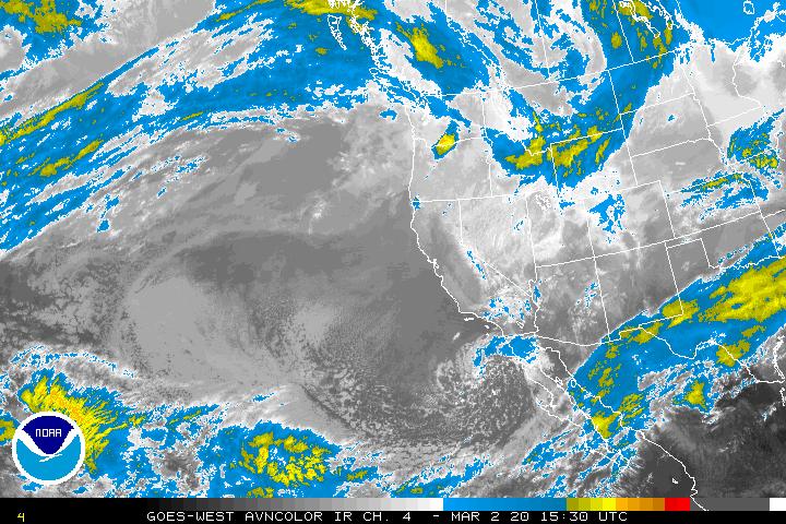
Goes West AVNColor Enhancement Sat Image. Click image to enlarge.

Up to 1,000 homes in the Los Angeles area have already been evacuated in anticipation of mudslides.

“We’re about as ready for the rains that will be coming as we can be,” said LA Mayor Villaraigosa. “If you don’t have to be on the road, why don’t you stay home?”

“We’re asking you to please cooperate,” Mayor Villaraigosa added. “There’s too many people not heeding advice.”

In La Canada Flintridge, a northern suburb of Los Angeles near the base of the San Gabriel Mountains, the residents were told to do exactly the opposite. Residents  along canyon roads were ordered to evacuate, and stay away for  four days.

“I cannot stress enough that this is not the time to stay,” said Mayor Laura Olhasso. “So if you’ve been asked to leave and you have left, please don’t be fatigued. Please leave again.”

“South of Los Angeles, near Long Beach and Huntington Beach, at least four funnel clouds were reported Tuesday — rare in California, and especially so in winter. Gary Sewall was in Huntington Harbour when he said he saw a catamaran lifted 50 feet in the air. ” ABC News said.

“I saw what looked like a water spout that was circling around,” he said, “and then we saw the boat out across the channel go up in the air and come crashing down.”

Heavy rain, flooding and mudslides have closed roads, inundated homes and cars causing damage. Powerful winds with gusts 130 km/h  gusts have damaged power lines leaving  more than 750,000 customers without power at times.  Up to four tornadoes have touched down in Southern California, this week!

Doppler Radar National Mosaic
NWS Radar Mosaic. Click Image to enlarge and update. (24-Hr FE ED).


Hazards. Click Image to enlarge and update. (24-Hr FE ED).


Snow Accumulation. Click Image to enlarge and update. (24-Hr FE ED).


Weather Forecast. Click Image to enlarge and update.
(24-Hr FE ED).


Predominant Weather. Click Image to enlarge and update. (24-Hr FE ED).


IR Satellite Image. Click Image to enlarge and update. (24-Hr FE ED).


Water Vapor Satellite Image. Click Image to enlarge and update.
(24-Hr FE ED).


Max Temps. Click Image to enlarge and update. (24-Hr FE ED).


Min Temps.
Click Image to enlarge and update. (24-Hr FE ED).


Temp – Real Time Mesoscale Analysis.
Click Image to enlarge and update. (24-Hr FE ED).


6-Hr Precipitation amount. Click Image to enlarge and update. (24-Hr FE ED)


12-Hr Probability Precipitation (%).   Click Image to enlarge and update. (24-Hr FE ED).


Wind Speed.  Click Image to enlarge and update. (24hr- FE EDT).


Wind Gusts.  Click Image to enlarge and update. (24hr- FE ED)


Sky Cover.
Click Image to enlarge and update. (24hr- FE ED)


River and Lake Levels. Click Image to Enter Portal.


US Seasonal Drought Outlook.
Click Image to enlarge.


Surface Weather Charts.
Click image to enter portal.

NWS Bot
For hazard warning codes see:
NOAA/NWS  US Weather Hazard Map


NOAA GOES 11 – Near Real Time Full Disk. Click image to enlarge.

Related Links:

Posted in El Niño, Pacific storm, Radar Mosaic, US Hazards Map, US Weather Map | Tagged: , , , , , , , , , , | 7 Comments »

Rick Strengthens to Cat 5 Hurricane

Posted by feww on October 18, 2009

For UPDATES see comments section below

Rick Intensifies to a Ferocious Category 5 Hurricane Near Mexico’s Pacific Coast

Rick is now an extremely dangerous category 5 hurricane headed toward Baja California peninsula.

Satellite imagery indicates that Rick has maximum sustained winds of 260 km/h (160 mph), the U.S. National Hurricane Center said.

A Category 5 hurricane, the highest on the five-level Saffir-Simpson scale, Rick could cause catastrophic damage in its path and beyond.

As of posting, Rick is about 370km (230 miles) south of Manzanillo, Mexico, and threatens to turn toward the Mexican coast on Tuesday, pummeling Baja California by early Thursday, on to mainland Mexico to dump an unprecedented amount of rain.

Rick is the  seventh hurricane of the season in eastern north Pacific.

GOES Northern Hemisphere Composite SECTOR IR Image

NHIR - GOES Composite
Hurricane Rick  at Cat 5  Strength – Northern Hemisphere Composite Sector (IR Ch 4) – still image dated as inset. Click image to enlarge and update.

Unenhanced satellite image of Rick at Cat 5 strength showing textbook eye and near-perfect symmetry

ir4 - Rick cat 5 18-10-09--01-45UTC
Hurricane Rick – Cat 5 – Still image – Dated as inset. Click image to enlarge and update.

Coastal Watches/Warnings and 5-Day Track Forecast Cone

Rick 5-day Track - 023514W5_NL_sm
Still image – Dated as inset. Click image to enlarge and update.

Tropical Storm Force Wind Speed Probabilities – 120 Hours

RICK TSF WSP
Still image – Dated as inset. Click image to enlarge and update.

GEIR - Full disk
GOES Full Disk East IR- Still image. Click image to enlarge and update. [Images are updated every three (3) hours.]

Other Images of Rick


Hurricane Rick – Cat 5 – AVNColor enhancement-  Still image – Dated as inset. Click image to enlarge and update.

NOAA Polar Mapped Mosaic Composites Showing Typhoon Lupit and Hurricane Rick

n18mer124_DDC - sml
Still image – Dated as inset. Click image to enlarge and update.

Other Satellite Images

GOES Satellite: East Pacific Hurricane Rick(EP20)

Additional Images:

Related Links:

Posted in Acapulco, East Pacific Ocean, FEWW New Hurricane Scale, Hurricane Rick, major hurricane, MANZANILLO, Mexico, Rick trajectory, Rick trajectory forecast | Tagged: , , , , , , , , , , , , , , | 4 Comments »